Alert
Alerts
Stroll through the mountain pastures - hiking trail
Description
A short, easy hike through farms and chalets, between roads and paths, at medium altitude and at the gateway to the alpine pastures.
Get closer to the mountains with this moderate hiking route, ideal for all hikers.
Starting from the Charbonnière parking lot, this trail takes you through forests before reaching the heights of the ski slopes. You'll enjoy panoramic views of the surrounding mountain range and the majestic Mont-Blanc.
As you stroll along, you may even spot cows grazing, adding a bucolic touch to your adventure. Accessible to hikers of all levels (blue - moderate), this trail is also open to walkers accompanied by their pets on a leash.
Between village and mountain pasture, this walk is an ideal way to discover the mountain world.
Technical Information
Altimetric profile
Starting point
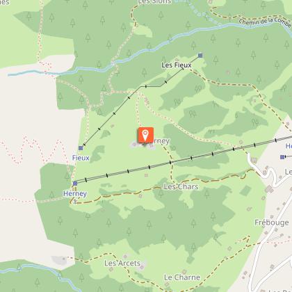
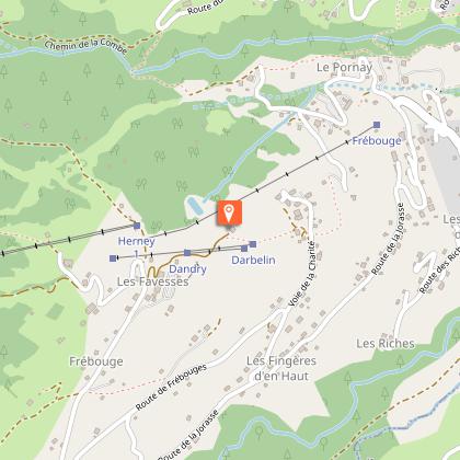
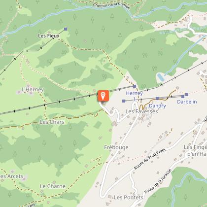
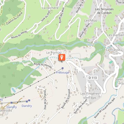
Points of interest
Additional information
Contact
Phone : 04 50 58 01 57
Email : info@cordon.fr
Website : https://www.cordon.fr
Open period
All year round daily.
Dates are indicative and may vary according to snow conditions. Please contact Cordon Tourisme for current conditions.
Subject to favorable snow and weather conditions.
Updated by
Cordon Tourisme - 22/05/2026
www.cordon.fr
Report a problem
Environments
Mountain view
Mountain location
Panoramic view
Type of land
Stone
Ground
Hard coating (tar, cement, flooring)
Not suitable for strollers
Topo guides and map references
Map references :
Mont-Blanc lookouts, IGN 1:25 base map or map of walks in the village or map of village trails (available free of charge)
Location complements
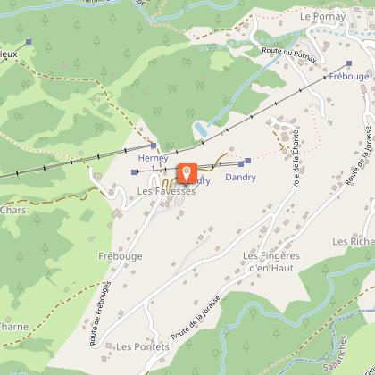
The Charbonnière parking lot is at the top of the Pornay hamlet.
Reception complements
Map available from the tourist office to discover these and other trails.
Whatever your hike, remember to pack cereal bars, plenty of water, sunglasses, sun cream, a small first-aid kit, and clothing suited to the season and weather forecast.
This itinerary can also be done accompanied, by hiring a mountain leader.
Tricky passages
None, but take care on the crossing, which can't be done too early in the spring (stream and snow bridges).
Guidebook with maps/step-by-step
1/ park in the Charbonnière parking lot
2/ follow signs for "Peray
3/ cross the torrent des Callabonnets.
4/ once at Le Peray, head for Les Sions and then Le Chanté.
5/ as you leave the forest, you'll reach the top of the ski slopes.
6/ then descend towards Cordon Centre as far as Charbonnière.
Animals
Yes. Dogs must be kept on a leash.
Data author
