Alert
Alerts
Les chalets de l'Avenaz - hiking trail
Description
A trail that winds its way through blueberry bushes in a magnificent spruce grove and among alpine meadows, with a magnificent view of the entire Mont Blanc range.
Discover the Chalets de l'Avenaz: to begin your adventure, head for the Lezaive d'en Haut parking lot. From here, a well-marked path takes you through the forest to Les Plaines, where picnic tables provide the perfect place to take a break.
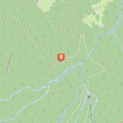
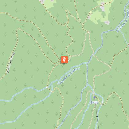
Continue on to Chalets de l'Avenaz: this typical mountain pasture, nestled in the heart of the mountains, is the ideal place to admire the surrounding peaks.
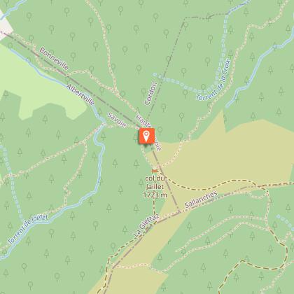
Your path will eventually lead you to the Col de Jaillet, with its breathtaking views over the valley and neighboring mountain ranges.
Accessible to hikers of orange level (fairly difficult), this route is also an excellent choice on hot days, thanks to its altitude and shaded areas.
Technical Information
Altimetric profile
Starting point
Points of interest
Additional information
Contact
Phone : 04 50 58 01 57
Email : info@cordon.fr
Website : https://www.cordon.fr
Open period
All year round daily.
Dates are indicative and may vary according to snow conditions. Please contact Cordon Tourisme for current conditions.
Information dated 28.03:
Please note: to do the hike from the Chalets de l'Avenaz, we recommend that you go up via the Plaines: today we strongly recommend that you make a round trip to avoid going down avalanche paths.
Subject to favorable snow and weather conditions.
Updated by
Cordon Tourisme - 19/05/2026
www.cordon.fr
Report a problem
Environments
Forest location
Mountain view
Mountain location
Panoramic view
Type of land
Stone
Ground
Not suitable for strollers
Topo guides and map references
Map references :
Map IGN 3430ET - LA CLUSAZ LE GRAND-BORNAND
Les Belvédères du Mont-Blanc map on sale for €7 at the tourist office.
Location complements
The stony forest road can be reached by car, or a footpath leads to the picnic area (approx. 1h);
Reception complements
Map available from the tourist office to discover these and other trails.
Whatever your hike, remember to pack cereal bars, plenty of water, sunglasses, sun cream, a small first-aid kit, and clothing suited to the season and weather forecast.
This itinerary can also be done accompanied, by hiring a mountain leader.
Tricky passages
No
Guidebook with maps/step-by-step
1/ Park at the Lezaive d'en Haut parking lot, at the start of the forest road.
2/ Take the forest road on foot (approx. 1h30 round trip) or by car (possibility of parking at the Les Plaines parking lot).
3/ Once at Les Plaines, follow signs for Chalet de l'Avenaz/ Petit Croise Baulet.
4/ Once at the Chalets de l'Avenaz, head back down towards Col de Jaillet.
5/ At Col de Jaillet, close the loop in the direction of Les Plaines.
6/ Take the forest road back to the Lezaive d'en haut parking lot.
Animals
Yes. Dogs must be kept on a leash.
Data author
