Colline de la Bergerie


Description
Classified as a Sensitive Natural Space since the 80's and property of the department of the Atlantic Pyrenees, the hill of the sheepfold represents a parenthesis of greenery in the heart of an urbanized area for the inhabitants of Cambo les Bains. Formerly high place of holiday, the castle which dominated the massif disappeared today but the English garden arranged at the time continues to delight young and old with its species of exotic trees of a remarkable diversity.
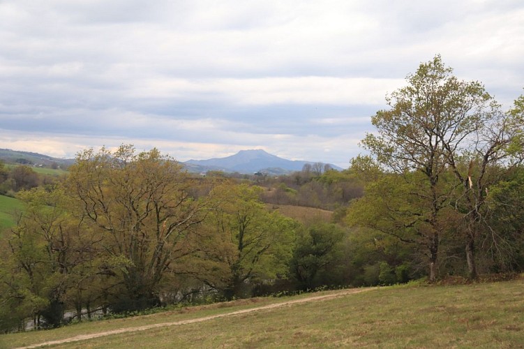
At the top, after having enjoyed an unobstructed view of the Basque mountains and walked along the avenue of hundred-year-old trees, you will reach the educational building "Elondare". Contraction of "Elorri Mendi" which means "the mountain of hawthorn" and "ondarea", "heritage", this building is intended to welcome the public for the purpose of biodiversity awareness.
Technical Information
Altimetric profile
Starting point
Steps
Ascension de la colline
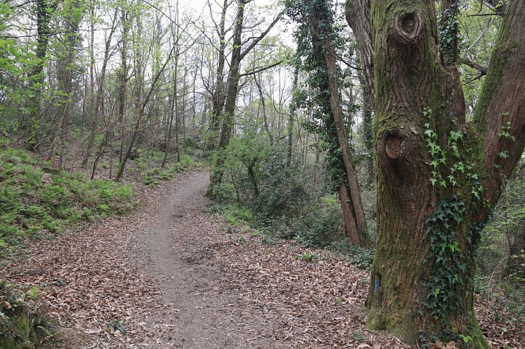
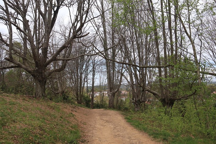
L’itinéraire commence sur une route goudronnée. Au bout de 100 m, un espace de jeux pour enfants se trouve sur la gauche. Suivre la route en laissant sur la gauche une entrée de propriété privée jusqu’à atteindre le début d’un sentier de terre en ascension prononcée sur une centaine de mètres puis plus douce. Le cheminement se poursuit sous un agréable couvert forestier peuplé de différentes essences d’arbres (chênes pédonculés, châtaigniers, merisiers, pins, etc.). Atteindre le plateau sommital après 670 m de progression. Suivre le sentier sous une allée de chênes jusqu’à atteindre le bâtiment Elondare.
Dans le bois
Traverser la piste et emprunter le sentier herbeux en face pour longer une clôture sur la droite. S'enfoncer dans le bois, passer un agrès sur la droite et descendre à droite après un banc sur un large sentier. Arriver en bas de la descente et tourner sur la gauche en longeant la départementale en contrebas sur la droite. Après 400 mètres sur un large sentier de terre, arriver au croisement d’une route.
Petite portion de route
Tourner sur la gauche. Rester vigilant au trafic routier sur la portion de 300 m de route puis tourner à gauche sur une large piste.
Forêt de hêtres
Continuer sur la piste qui se rétrécit en laissant sur la gauche un bâtiment de captage d’eau. Le cheminement se poursuit au cœur de beaux spécimens de hêtres taillés en têtard. Continuer toujours tout droit jusqu’à rejoindre une portion de route à suivre sur 300 m jusqu’au parking de départ de la randonnée.
Points of interest

Bâtiment Elondare
Conçu entièrement en bois et en forme de feuille, son nom provient de la contraction de « Elorri Mendi » qui signifie « la montagne de l’aubépine » et « ondarea », « le patrimoine ». Ce bâtiment est destiné à accueillir le public à des fins de sensibilisation à la biodiversité. Les visiteurs pourront y trouver des informations sur l’Espace Naturel Sensible de la Colline de la Bergerie, son histoire et sa gestion. Le département des Pyrénées Atlantiques y propose des animations sur la nature et notamment l’observation d’abeilles dans des ruches pédagogiques installées par l’association « Nature et Abeilles » de Larressore.

Hêtres têtard
Espèce appréciant les zones fraîches et humides, le hêtre trouve sur le versant Nord toutes les conditions pour s'épanouir. Les quelques beaux spécimens présents ici sont taillés en têtard. Appelés aussi "trognes" ces arbres ont subi pendant des décennies des coupes basses successives qui leur ont donné ces formes si particulières. Ces tailles, souvent effectuées dans un but d'alimentation en bois de chauffage, ont pour conséquence l'apparition de cicatrices sous forme de bourrelets. La présence de ces arbres est une aubaine pour les insectes saproxyliques (se nourrissant de bois mort) et de fait, pour des oiseaux comme le pic qui se nourrissent de leurs larves.
Additional information
Balisage
Yellow
Tronçon 1 & 2: tracé rouge et blanc du GR + tracé jaune du PR - Tronçon 3 & 4 : tracé jaune du PR
Typologie de l'itinéraire
Loop
Durée moyenne de l'expérience
1 to 2 hours
Thèmes
Natural
