Alert
Alerts
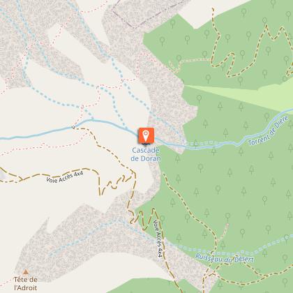
Hiking Trail: Doran via the Gypaète trail


Description
This forest path, whose slopes are a little steeper than the classic route, allows you to stay cool in the summer but especially, ensures you avoid the 4x4s.
On arrival, there is a magnificent view over the Pointe Percée, the highest point (2750 m) in the Aravis range.
Technical Information
Altimetric profile
Starting point
Points of interest


Date and time
- From 15/05/2026 to 15/10/2026
- From 15/05/2027 to 15/10/2027
Additional information
Environments
Forest location
Mountain view
Updated by
Office de Tourisme de Sallanches - 15/01/2026
www.sallanchesmontblanc.com
Report a problem
Open period
From 15/05 to 15/10.
Subject to favorable snow and weather conditions.
Contact
Phone : 04 50 58 04 25
Email : tourisme@sallanches.com
Website : http://www.sallanchesmontblanc.com
Facebook : https://www.facebook.com/SallanchesMontBlanc
Type of land
Ground
Grit
Not suitable for strollers
Animals
Yes
Data author
