Alert
Alerts
2-day hike on the lammergeier trail
Description
A short 2-day itinerary in the heart of the Doran mountain pastures. At the end of your first day's walk, you'll have a magnificent view of the 2750m-high Pointe Percée.
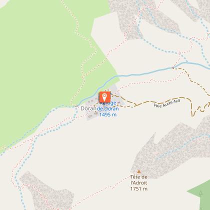
Nestling in the heart of an imposing cirque of mountains dominated by the Pointe Percée, the highest peak in the Aravis range, the Doran mountain pasture offers you the chance to observe - from June to September - its ancestral agro-pastoral and cheese-making activities, where you can buy fresh cheese.
Trace the astonishing history of a chapel built by the scouts, and discover Alpine flora and fauna, including the astonishing Bearded Vulture, reintroduced here a few years ago.
The charming Doran refuge offers a warm welcome for a drink, blueberry tart and an exceptional night's sleep.
Technical Information
Altimetric profile
Starting point
Points of interest


Date and time
- From 15/04/2026 to 30/09/2026
Additional information
Open period
From 15/04 to 30/09.
Subject to favorable snow and weather conditions.
Updated by
Conseil Départemental de la Haute-Savoie - 15/01/2026
www.hautesavoiexperience.fr
Report a problem
Environments
Mountain view
Mountain location
Contact
Phone : 04 50 58 04 25
Email : tourisme@sallanches.com
Website : http://www.sallanchesmontblanc.com
Type of land
Ground
Grit
Not suitable for strollers
Location complements
Access (by car): From Cluses, join Sallanches (D1205). In Sallanches, fork right onto route du Rosay, then route de la Provence. Always follow "Outredière" signs until you reach the Outredière parking lot.
Topo guides and map references
Map references :
TOP 25 IGN 3430 ET - LA CLUSAZ / LE GRAND-BORNAND
Reception complements
Don't forget to book your accommodation in advance.
Guidebook with maps/step-by-step
1/ DAY 1 - From the "Plan Chevallier" parking lot to the Refuge de Doran. Follow the signs for "Doran par le sentier du Gypaète", then from "Pont d'Outredière" follow "Doran". Before reaching the Doran mountain pastures, you'll pass the following signposts: "Bois des Avenières", "Pont d'Outredière", "Outredière", "Les Pendants", "Les Prés d'Outredière", "Passerelle de Dière" and "Prise d'eau". Arrival at "Alpage de Doran" and overnight at the Refuge de Doran.
2/ DAY 2 - From the Refuge de Doran to the "Plan Chevallier" parking lot. Take the 4x4 access road back down to make a loop. Continue in the direction of "Plan Chevallier" to find the parking lot and your starting point.
Animals
Yes. Pets allowed on leash only. Please contact the Doran animal shelter for information on pet-friendly conditions.
Data author
