Alert
Alerts
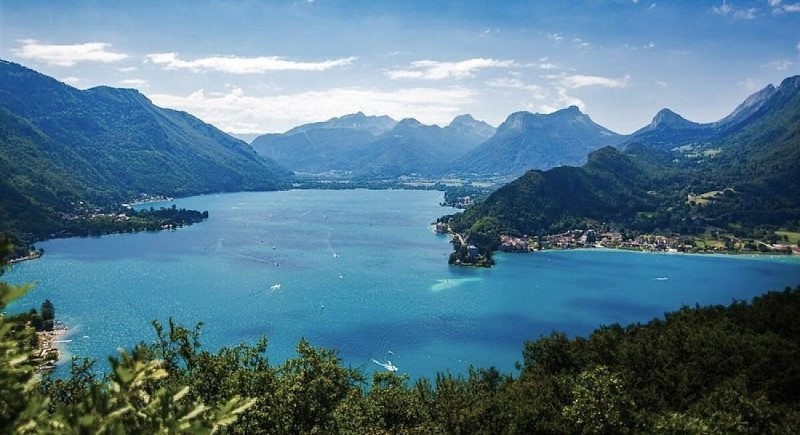
Reaching Roc de Chère via Talloires : In the footsteps of the past
Description
A magnificent walk that retraces the history of the historic site in a fun and educational way.
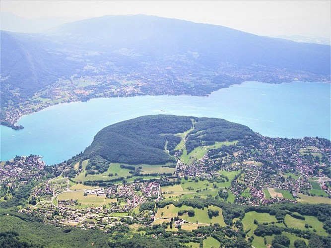
From the car park, head towards Talloires Abbey. Walk along the shoreline via the narrow passageway on the edge of the lake. You will come to a nature reserve information panel. Now take the path on the right that climbs up the wooden steps. The beginning is quite steep. At the "Sous le belvédère" sign, turn right towards the "Belvédère du Roc de Chère". The path climbs uphill, so watch out for the path marked with a cross. After admiring the view of the Bauges and the lake, turn left towards "la patte d'oie" and continue straight on towards "Talloires par les Granges". Following the markers, go along the golf course on your right and you'll soon come to the "Granges d'Echarvines" sign. Take the path on your right which climbs slightly towards the "Belvédère de la Crête". On the way up, after about 10 minutes, don't miss the first viewpoint on the right (marker). This is the only place from which you can see the entire Roc de Chère massif. Panoramic views of Lake Annecy, Le Semnoz on the opposite side, Mont Veyrier and Le Parmelan on the right will complement the views from the other viewpoints further on. Continue uphill and once you've reached a flatter area, you'll come to the "Belvédère de la Crête". A quick round trip (50 m) will take you to the panoramic view of the small lake, La Tournette to the left and the Bauges massif opposite. Take the path downhill towards "Belvédère du Roc de Chère". Retrace your steps and descend to the left as far as the sign for "Sous le belvédère". Turn left towards "Baie de Talloires" on a steep descent.
Technical Information
Altimetric profile
Starting point
Points of interest


Additional information
Public transport
Bus No. 60 Transdev Along the cycling route around the lake.
Advice
Hikes require sturdy hiking footwear. The first slope is steep and can be difficult for novice hikers on both the initial and return journeys. Alternative route from Echarvines: follow the Comballe path. You are in a nature reserve, so please respect its fragile nature. Always exercise caution and plan ahead when hiking. Asters, CEN 74 cannot be held responsible for any accident or incident that may occur on this trail.
Animaux acceptés
De manière générale votre chien, s’il est autorisé, doit être tenu en laisse en espaces naturels.
Par sa présence, son odeur et ses déjections, votre chien peut perturber la biodiversité. Sa divagation dans la nature peut avoir des conséquences lourdes pour la faune sauvage et les troupeaux (transmission de germes, stress de la faune sauvage, destruction des couvées au sol).
Les chiens sont interdits en cœur de parcs nationaux et dans la plupart des réserves naturelles.
Advised parking
Talloires public parking
Access
From Annecy, take the road D909a through the village of Talloires along the eastern shore of the lake. Park in the public car park (for which there is a fee in summer) just outside the village centre. From Faverges: take the road RD 1508 to the Doussard roundabout. At the roundabout, follow signs for Talloires.
Arrival
Talloires public parking
Ambiance
Follow a historic route, built a long time ago by the monks of the Abbey of Talloires to search for wood. This hike offers a nice contemplative break with several viewpoints on the lake of Annecy and the mountains.
Departure
Public parking lot of Talloires
Data author
