Alert
Alerts
Mont Saint Michel and the croix Tête de Beurre

Description
Get ready for a fairly long, sporty itinerary on the outskirts of town. At the top, contemplate the view of the Belledonnes massif, the Bauges, the Granier, as well as the valley, and watch the gliders in full flight.
D/ Car park at the lake
1/ Walk along the lake, then along the left bank of the Ruisseau de la Mère, past the campsite and parking lot, turn left and cross the bridge.
2/ At the roundabout, follow the road up to the château. At the château, fork right; after the last houses, continue on the small road and then the footpath until you reach the Challes balconies footpath.
3/ Turn right, and at the fork in the road take the sports trail to Mont Saint Michel.
Go up through the woods until you reach the chicane giving access to the Bellevarde meadow.
At the farm, leave the aerial path leading directly to Mont Saint Michel and take a detour along a flat path at the top of the Camelot gorge.
4/ Join the path heading towards Barby, and at the stele, climb up towards Curienne on a wide track.
Go around the Motte Castrale, then take the path that leads through the meadows to Mont Saint Michel.
5/ To return, retrace your steps and at the first crossroads take the gently sloping path to the right.
The slope soon accelerates. You leave the path that leads back to the Bellevarde farm to continue your descent.
It's possible to take the little path on the right that leads to the pretty viewpoint of the tête de beurre cross.
After this little detour, retrace your steps and follow the long descent that takes you to the hamlet of Les Boisserettes, surrounded by vineyards.
6/ Cross the stream once, then a second time along the right bank.
At a place called Les Passerelles, you leave this small valley unimpressed by the fanciful "Challes les Eaux 1h30" sign to climb the small hill.
7/ Finally, take the botanical trail up to Challes les Eaux.
Take the small Chemin des Monts road down to the Casino and the thermal baths along quiet lanes.
From the thermal baths, you can easily reach the roundabout to return to the outward route along the stream.
Technical Information
Altimetric profile
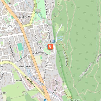
Starting point
Points of interest

Additional information
Contact
Phone : 04 79 33 42 47
Email : accueil.chambery@chamberymontagnes.com
Website : https://www.chamberymontagnes.com/randonnees-et-trail/
Open period
All year round.
Environments
Mountain view
Panoramic view
Beach within 300 m
In the country
Close to a public transportation
Bus stop < 500 m
Village 2 km away
Type of land
Stone
Ground
Hard coating (tar, cement, flooring)
Not suitable for strollers
Location complements
By car: park in the car park of the Plan d'Eau, rond-point Aviateur Joseph Thoret.
By bus: from the centre of Chambéry, take line 2 (direction Gonrat / Les Frasses) and get off at the "Plan d'eau" stop. More information on synchro.grandchambery.fr.
Updated by
Grand Chambéry Alpes Tourisme - 09/02/2026
www.chamberymontagnes.com
Report a problem
Reception complements
Walking shoes and poles recommended.
Guidebook with maps/step-by-step
D/ Car park at the lake
1/ Walk along the lake, then along the left bank of the Ruisseau de la Mère, past the campsite and parking lot, turn left and cross the bridge.
2/ At the roundabout, follow the road up to the château. At the château, fork right; after the last houses, continue on the small road and then the footpath until you reach the Challes balconies footpath.
3/ Turn right, and at the fork in the road take the sports trail to Mont Saint Michel.
Go up through the woods until you reach the chicane giving access to the Bellevarde meadow.
At the farm, leave the aerial path leading directly to Mont Saint Michel and take a detour along a flat path at the top of the Camelot gorge.
4/ Join the path heading towards Barby, and at the stele, climb up towards Curienne on a wide track.
Go around the Motte Castrale, then take the path that leads through the meadows to Mont Saint Michel.
5/ To return, retrace your steps and at the first crossroads take the gently sloping path to the right.
The slope soon accelerates. You leave the path that leads back to the Bellevarde farm to continue your descent.
It's possible to take the little path on the right that leads to the pretty viewpoint of the tête de beurre cross.
After this little detour, retrace your steps and follow the long descent that takes you to the hamlet of Les Boisserettes, surrounded by vineyards.
6/ Cross the stream once, then a second time along the right bank.
At a place called Les Passerelles, you leave this small valley, unimpressed by the fanciful "Challes les Eaux 1h30" sign, to climb the small ridge.
7/ Finally, take the botanical trail up to Challes les Eaux.
Take the small Chemin des Monts road down to the Casino and the thermal baths along quiet lanes.
From the thermal baths, you can easily reach the roundabout to return to the outward route along the stream.
Animals
No
Data author
