Alert
Alerts
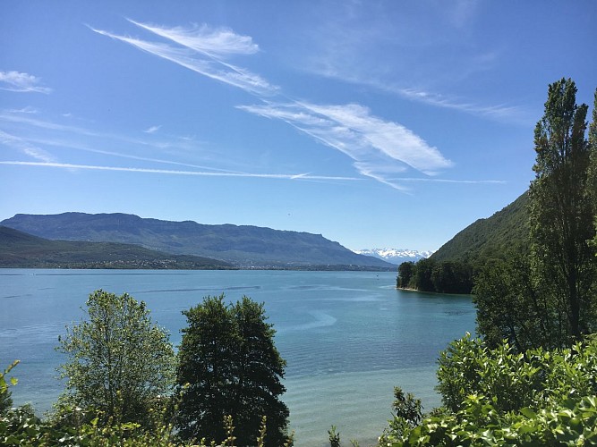
Tour du Lac du Bourget - Stage 3: From St Pierre de Curtille to Le Bourget du Lac
Description
This stage takes you through the imposing Massif de l'Épine. You'll discover the wild coastline of Lac du Bourget, which takes on different hues depending on the season and the sunlight, the famous Abbaye d'Hautecombe and the Dent du Chat.
Savoie Rando Lac à pieds" hikes take you around France's largest natural lake. The 4 stages of the tour can be done separately.
Technical Information
Altimetric profile
Starting point
Additional information
Updated by
Agence alpine des territoires - 30/06/2025
www.agate-territoires.fr
Report a problem
Environments
Mountain location
Topo guides and map references
Map references :
Grand Lac hiking map on sale for €3 at tourist information offices.
Map IGN TOP 25 - 3332OT - CHAMBERY AIX-LES-BAINS LAC DU BOURGET on sale in shops.
Open period
All year round between 8 am and 5 pm.
Type of land
Not suitable for strollers
Contact
Phone : 04 79 88 68 00
Email : accueil@aixlesbains-rivieradesalpes.com
Website : https://www.aixlesbains-rivieradesalpes.com
Guidebook with maps/step-by-step
This stage takes you through the Massif de l'Epine. You'll overlook the wild
Lac du Bourget, Hautecombe Abbey and the famous Dent du
Chat.
Return by train to/from Vions station. Timetable available
on www.ter.sncf.com/rhone-alpes/. Return boat trips from/to
to Chanaz harbor, Aix-les-Bains and Hautecombe Abbey. Timetable
available at www.compagniedesbateauxdulac.fr / Tel. 04 79 63 45 00
Departure: Camping le Saint-Pierre at Saint-Pierre-de-Curtille ➔ arrival at Bourget du Lac ➊ From the village of Saint-Pierre-de-Curtille, head towards Ontex.
➋ Leave the RD914 to take a small road on the right that takes you
the heights of Billon.
➌ Continue on the track that crosses the fields and climbs through the woods
towards the village of Ontex.
➍ Follow the signs for "La Chapelle du Mont du Chat" as far as "Le Mont" (plot with Virgin Mary).
➎ You can then reach Hautecombe Abbey (shown on the map).
map)
➏ Continue straight on towards Le Bourget du Lac. A long, wide
long, wide forest track leads to the hamlet of Col du Chat.
Col du Chat.
➐ Take the path down towards Bour
Animals
Yes. Dogs on leash
Horses not allowed on the course.
Data author
