Alert
Alerts
La Trescoulade


Description
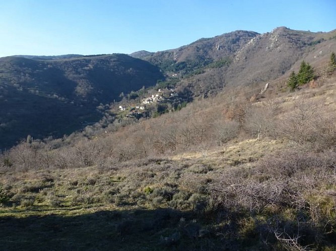
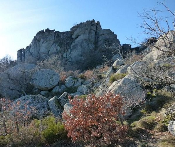
From ridge to forest, col (pass) to col, this trail brings the hiker into contact with a great variety of environments and offers uninterrupted panoramic views onto the Arre valley, the Causse de Blandas, the Anjeau mountains and the Trude massif.
Walk along the D 189 towards Peyraube. About 50 m after the disused railway bridge, fork left. Take the stone path for 100 m, to a road. Cross it and head towards Blanquefort. Once you are on the D 189, turn left and walk to the sign for Peyraube. As you enter Peyraude, fork left onto a tarred lane that goes uphill and, at the first house, leave this lane to take a track on the left towards Bonnels farm. As you leave Bonnels, the path goes uphill among broom to the Col des Airettes (altitude 970 m). Take a forestry track on the right to the Col des Tempêtes (997 m). There, go right on the Cazebonne road that leads to the Col de l'Homme-Mort. At the second crossroads, turn right to reach the Barrière road. At the sign for La Condamine, walk downhill on the forestry track on the right for 100 m and go through the fence. Take a path through the broom heath on your left heading for Le Garel brook (i.e. westwards), so as to bypass the ridge on its left. After 200 m, you reach a calade (paved track). This skirts Les Ramasses on the left and takes you straight to the ruins of Le Garel. Head back towards the ridge to reach the Rocher de Saint-Peyre. From there, the path zigzags downhill to the ridge that separates Arrigas from Aumessas. It leads to a track, with Peyraube and Blanquefort on the right, and arrives in a landscape of well-maintained fields. Continue between two box hedges. Go straight downhill to Arrigas. The path cuts across the D 189 twice before ending in the village.
Technical Information
Altimetric profile
Starting point
Points of interest

Additional information
Departure
Arrigas
Arrival
Arrigas
Ambiance
La Trescoulade Trail is a forest hike to the ridges and passes of this valley. The word trescoulade is Occitan and means “to disappear behind the heights, to cross a pass”. It perfectly describes the ambiance of this path.
Access
From Le Vigan, take the D 999 towards Alzon. At Les Trois Ponts, take the D 789 towards Aumessas - Arrigas
Advised parking
Church square in Arrigas
Advice
Make sure your equipment is appropriate for the day's weather conditions. Remember that the weather changes quickly in the mountains. Take enough water, wear good shoes and put on a hat. Please close all gates and barriers after yourself.
Is in the midst of the park
The national park is an unrestricted natural area but subjected to regulations which must be known by all visitors.
Data author
