Alert
Alerts
Mont Tournier hike
Description
This day hike promises many discoveries on the slopes of Mont Tournier! Overlooking the Rhône or the green valleys, your walk is punctuated by historical, natural and landscape nuggets.
As you climb to Mont Tournier, take in the breathtaking views from the belvederes overlooking the Rhône. This forested mountain also holds many secrets from the past. Step into the shoes of the knights who watched over the Rhone from the ancient lookout posts. Can you spot the cave in the forest where the first settlers lived? On the gently sloping return journey, the scenery opens out onto lush green countryside dotted with tiered villages overlooking the Yenne plain.
But be careful! In the Glaize woods, the route crosses private property. The owner graciously authorizes your passage. We therefore ask you to respect the following rules: do not stray from the marked path, do not make fires, do not leave garbage, do not camp, and do not harm the fauna, flora, livestock or crops.
Technical Information
Altimetric profile
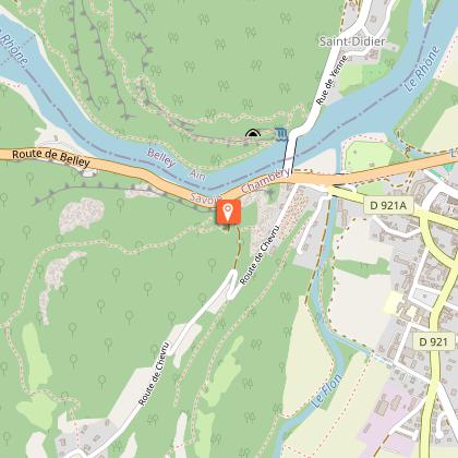
Starting point
Additional information
Contact
Phone : 04 79 36 71 54
Email : info@yenne-tourisme.fr
Website : http://www.dentduchat.fr
Open period
Throughout the year : open daily.
Environments
In the country
Type of land
Grit
Location complements
Bus stop near Yenne town center named Salle des Fêtes on route no. S02 173 (Chambéry/Yenne/Belley). By car, you can park in the Place des Vieux Moulins parking lot or in the parking lot opposite the Maison de la Dent du Chat. Free parking. Hiking signs can be seen near the Maison de la Dent du Chat.
Updated by
Office de Tourisme de Yenne - 14/01/2026
www.dentduchat.fr
Report a problem
Reception complements
Bring hiking boots.
Drinking water points available in Yenne and Botozel (Traize).
Guidebook with maps/step-by-step
Departure behind the church of Yenne.
1/ Head towards Yenne cemetery (230 m), then follow the road to Chevru. Follow the GR9-GR65 up to the chapel Notre Dame de la Montagne
2/ 100m after the chapel, a first viewpoint offers a panoramic view of the Rhône river and the tomb of Pierre Boisson.
3/ Continue through the forest to the second viewpoint via ‘La Prison’ (345 m). 4/ Reach the ‘Pierre-Châtel viewpoint’ (480 m) and look out over the old Carthusian fortress.
5/ Continue to the third viewpoint overlooking the Rhône plain.
6/ Continue towards ‘Pré Cevin’ 545 m via the Croix de Chevru.
7/ Hike through the Mont Tournier forest via Les Farnets, le Puits de Bacchus, Botozel, Bois de Glaize,,as far as the Recorba lookout.
8/ Reach Pierre Chapautée and leave the GR for the return journey along La Magne, Labully, Les Rochettes.
9/ Cross the hamlets of la Tuilière, les Malods, Charosse by the road. 10-Return to the country lane to reach the Yennois hamlet of Les Couleurs.
Animals
Yes. Pets allowed on leash only.
Data author
