Alert
Alerts
Tour du Rateau d'Aussois

IGN cards


Description
This hike will allow you to discover the high mountains before gradually bringing you back to your starting point by a long panoramic trail through the alpine pastures and forest.
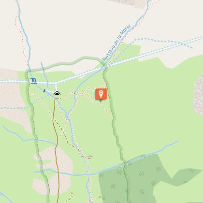
"Park at the Orgère car park, end of the road. Then take the old EDF track, located at the bottom of the car park. Follow the route for “Col de la Masse”. Pass a concrete bridge that straddles the Povaret stream to reach the foot of the Aiguille Doran. Continue along the trail, cross a wooden footbridge to cross the Masse stream, then continue on this winding trail until you reach a crossing. Turn left as indicated by the sign ""Col de la Masse"". At the pass, you can descend by the same route and shorten the journey time. The more adept can also reach the summit of the Rateau d’Aussois by a sparsely marked and steep path. Otherwise, continue the circuit by a relatively marked descent path and reach a vast sloping ledge: the Plateau du Mauvais Berger Then follow the sign for ""Col du Barbier"" and continue through a terraced path, passing through the Col du Barbier and chalets. Then go back down through the forest, then after a sloping ledge still in the forest go up slightly to return to the Orgère valley. Pass in the vicinity of the restored chalets, come to a stone bridge allowing you to cross the Povaret stream. Continue on, then cross a group of buildings, including a chapel on your left. Follow the markers for the discovery trail and climb through a Scots pine forest by a winding path. Come out on to a road, climbing back up to reach the car park where you departed."
Technical Information
Altimetric profile
Starting point
Points of interest


Additional information
Advised parking
Orgère car park, Villarodin-Bourget
Public transport
" Rail connection to Modane. Information: www.voyages-sncf.com No public transport between Modane and Orgère car park. Suggested hitchhiking organised in the Haute-Maurienne valley. Information: www.rezopouce.fr "
Is in the midst of the park
The national park is an unrestricted natural area but subjected to regulations which must be known by all visitors.
Accessibility infrastructure
Two disabled parking spaces, certified “Accessible Tourism” for the 4 types of disability.
Access
From the exit of the A43 motorway, take the direction of Modane. At the Freney roundabout, take the RD 106 towards the Refuge de l´Orgère which is signposted. After a 30 minute drive, pass the Refuge on your right to access the car park.
Arrival
Orgère car park, Villarodin-Bourget
Ambiance
After zigzagging through the alpine pastures, you will be surprised to meet a mineral landscape specific to the high altitude. Ÿet by venturing further into these places, you will discover all the riches of the bright shimmering flowers and a discreet but ubiquitous fauna. This itinerary is filled with opportunities to see the fauna, perhaps leading you to encounter the ibex, surprise a ptarmigan or a mountain hare or see a bearded vulture.
Departure
Orgère car park, Villarodin-Bourget
Data author
