Alert
Alerts
Walking loop from the Carro balcony to its refuge


IGN cards


Description
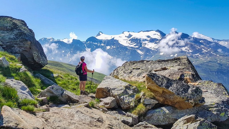
This stunning mountain trail offers amazing views of the Albaron, Vallonnet and Evettes glaciers, their reflections mirrored in the surrounding mountain lakes. The shades of blue, from azure to turquoise, are always surprising.
As you make your way along the path through the high-altitude meadows,
you'll come across alpine chalets with unique shapes. These chalets are
designed to withstand avalanches, with some being semi-buried or protected
by a "tourne," which is a stone prow. Amid the glaciers of Albaron, Vallonnet,
and Evettes, you make your way along this breathtaking trail that overlooks
the Sources de l'Arc cirque. You pass a number of lakes and the views never
cease to amaze you. Azures and turquoises unfold before your eyes, in a
stunning parade of shades of blue. A few chamois can be seen in the distance.
You get to the refuge, see how perfectly it blends into the rugged background
of the mountains. Check out the view of the lakes from above. It feels like
you're at the end of the world! This is a dream opportunity to spend a night
under the stars and the crystalline sky of the high-altitude mountains. Make
a wish for every shooting star!
On your way down, take some time to visit the hamlet of l'Écot and Bonneval-sur-Arc. Isn't that Sebastian who running down an alley, followed by his
faithful Belle?
Technical Information
Altimetric profile
Starting point
Points of interest


Date and time
- From 15/05/2026 to 15/10/2026
Additional information
Open period
From 15/05 to 15/10.
Subject to favorable snow and weather conditions.
Updated by
Agence alpine des territoires - 24/11/2025
www.agate-territoires.fr
Report a problem
Environments
Near shuttle stop
Lake view
Mountain view
Mountain location
Close to a public transportation
In a nature reserve
Presence of livestock and guard dogs
Contact
Phone : 04 79 05 99 06
Email : info@hautemaurienne.com
Website :
https://www.haute-maurienne-vanoise.com
http://www.cchautemaurienne.com/jy-vais-en
Type of land
Rock
Stone
Ground
Not suitable for strollers
Location complements
By bus: Line 4 - Pont de l'Ouilletta stop
Topo guides and map references
Topo guides references :
Savoie Mont Blanc on foot" TopoGuide
Map and booklet "Haute Maurienne Vanoise. 115 walks and hikes - 35 trail routes. For all levels" (sold for €10 in Tourist Offices) - Black route n°113
Map references :
Map IGN 3633ET - Tignes Val-d'Isère
Reception complements
The duration of hiking trails is calculated using reference paces: 300 m/h ascent, 500 m/h descent and 4 km/h on the flat.
As hazards may occur at any time on the routes, the GPX tracks provided are not contractual. They are given for information only. Riders use them at their own risk, depending on their level of technological proficiency and their understanding of the terrain.
Guidebook with maps/step-by-step
To guide you in the field, consult the "step-by-step" directional diagram provided in pdf.
Animals
No. Pets are not allowed on this hike in the Vanoise National Park.
Data author
