Alert
Alerts
The roof of the Limousin


Description
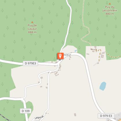
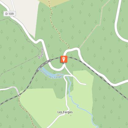
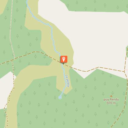
The Limousin seen from the sky... It is easier to understand an area when you fly over it, then use a zoom effect to descend and see the elements it consists of. Everything here is unique.From the Mont-Bessou tower car park, go straight down the road to the village of Lavaur.In Lavaur, turn right onto the D979 E3 (Variant: continue straight ahead). Then turn left towards the village of Lespinat.In Lespinat at the D109, turn right and then immediately left. The road becomes a path. Join a forest track that you take on the right. Continue straight on for 1 km and then take the small road on the right. Go through Le Goumoueix and return to the D109 (off the trail on the left: The return journey to the Douglaseraie des Farges takes about 5 minutes).Take the road on the right and then, after the railway bridge, take the second path on the left. This rises; turn left at the next crossroad and reach the Beech Road.Take the road on the left for a long time, leaving pathes on your left and right. Leave on your left the road to Le Cloup, carry on the Beech Roads for another 1,5 km.At the track, take it on your left. Leave the path on the right and when you come to the D979.Cross it to follow a track. Leave the track on the right and continue straight ahead until you reach a T-junction. Take the track on the right. Ignore another track on the right. At the T-junction, turn right. Continue for 1 km and turn left to join the D979.Cross it and continue straight along this small road. At the next crossroads, turn left and then take the path on the right at the car park. At the next path crossing, turn right to go up to the panoramic tower.
Technical Information
Altimetric profile
Starting point
Steps

Additional information
Advised parking
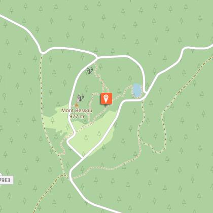
Tower of Mount Bessou, Meymac
Advice
Departure from Sechemailles: from the holiday village, head towards the lake and turn right. Follow the lake to the Ambrugeat car park, crossing the beach, the fitness trail and the two culverts in succession. Opposite the chateautake the minor road towards Le Goumoueix.If it offers pretty views, the road of the haggeries constitute a long paved portion
Access
6.5 km from Meymac, take the D36.
Ambiance
Rise up onto the Limousin Mountain following the local Beech Road and observe through huge window-like openings cut through the forest, the distant horizons that open onto the Monts d'Auvergne, with, in the foreground, the high Corréziens plateaus and the countless valleys where the rivers snake through. Descend to explore the wetlands at the bottom, where peat bogs have been forming for thousands of years. Turn your head to the right, to the left, here nothing is the same; here everything is magnificent; here you can breathe.
Arrival
Tower of Mount Bessou, Meymac
Departure
Tower of Mount Bessou, Meymac
Data author
