GRANDE BOUCLE CIRCUIT

Description
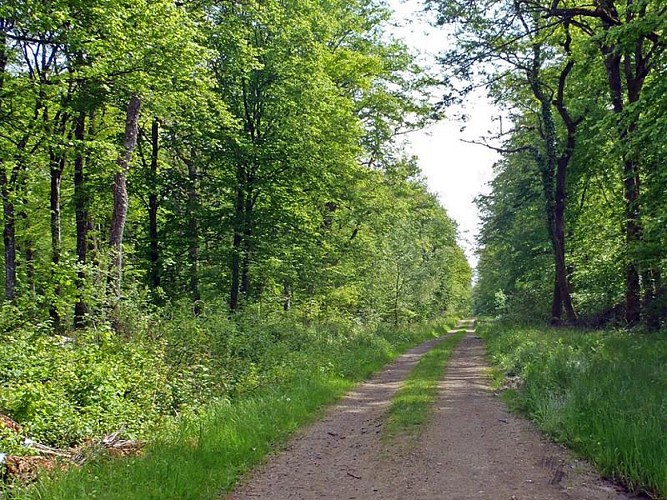
This route, which is accessible to all, is suitable for walking and hiking. It allows you to discover the small local heritage such as the old border markers, the Voie de Soixante (a narrow railway line which transported ammunition and supplies to the forts of the Maginot Line) and the Chapelle de Bassompierre with its characteristic choir of the Lorraine religious buildings of the early 12th century. You can also visit the violin-making workshops in the centre of the village of Bassompierre.
Technical Information
Altimetric profile
Starting point
Points of interest

ANCIENNES BORNES FRONTIÈRES
Following the 1870 war and the Frankfurt Peace Treaty of May 10, 1871, the territories of Alsace-Moselle became German. Northern Moselle (Jarny and Longwy) remained French. Boundary markers were installed when the Meurthe et Moselle département was created. These markers demarcate the various "Franco-German" territories. Indeed, some communes became German. France gave Germany twelve communes in the Pays Haut Mosellan.
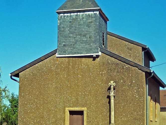
CHAPELLE DE BASSOMPIERRE
The Bassompierre chapel, also known as the Saint-Luc chapel, is now part of the Boulange commune. It is an ancient Romanesque building. This style was developed by monastic orders between the 10th and 12th centuries. It was the burial place of the local lord, marquis and later baron of Bassompierre. At the time, the chapel belonged to the Château de Bassompierre.
VOIE DE 60
The "voie de 60" is an old railroad line linked to the Maginot line. The Boulange station was used to transfer material and men between the normal track and the network of fortress 60s. This track linked major artillery works such as Molvange and Rochonvillers. It was mainly used for supplies to various works. Not all military works are equipped with railways. They are supplied by truck.

RESTAURANT LE TOQUÉ
Des plats délicieux où les petits détails font la différence. Restaurant parfait pour passer un moment entre amis ou en famille. Une cuisine typiquement française et traditionnelle. Vous pouvez déguster dans ce restaurant du foie gras, du magret de canard, de l’agneau et aussi du filet de bœuf. Pour les amateurs de grenouilles et escargots, c'est ici qu'il faut venir ! Vos papilles seront mises à l’épreuve durant le repas !
Additional information
Contact
Tel : 03 82 53 33 18
Email : tourisme@thionville.net
Producteur de la donnée
Ces informations sont issues de la plateforme SITLOR - Système d’Information Touristique - Lorraine
Elles sont synchronisées dans le cadre du partenariat entre Cirkwi, l’Agence régionale du Tourisme Grand Est et les membres du comité technique de Sitlor.
Data author
