Alert
Alerts
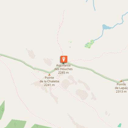
Hiking : Aiguillette des Houches


Description
A magnificent hike in the heart of the Carlaveyron nature reserve. Magnificent panoramas of the Mont-Blanc massif, the wet meadows of Carlaveyron, the Fiz, the Aiguilles Rouges, all the way to Le Buet.
A panoramic hike par excellence, the Aiguillette des Houches is a superb vantage point for observing the Mont Blanc massif.
Although challenging, the ascent through the Chailloux mountain pastures is surrounded by beautiful green landscapes, right in front of the Bossons glacier, Europe's largest icefall.
The arrival at the Aiguillette des Houches will reward your efforts, with an exceptional 360° panorama: on one side the imposing cliffs of the Fiz chain and the Aiguilles Rouges, on the other the Mont Blanc Massif.
The return journey takes you to the heart of the Plateau de Carlaveyron, a nature reserve characterized by its many waterholes nestled between the relief.
You'll then make your way to the Bellachat refuge, a superb vantage point overlooking the Chamonix valley. Here you can take time out for a bite to eat, overlooking the Toit de l'Europe.
On departure or arrival, you can discover the Parc Merlet, a wildlife park where you and your family can observe the typical wildlife of our mountains (marmots, ibex, chamois, etc.).
Technical Information
Altimetric profile
Starting point
Points of interest


Date and time
- From 15/05/2026 to 15/10/2026
- From 15/05/2027 to 15/10/2027
Additional information
Open period
From 15/05 to 15/10.
Subject to favorable snow and weather conditions.
Updated by
Conseil Départemental de la Haute-Savoie - 21/04/2026
hautesavoiemontblanc-tourisme.com/
Report a problem
Environments
Mountain view
Mountain location
In a nature reserve
Panoramic view
Contact
Phone : 04 50 53 00 24
Email : info@chamonix.com
Website : https://www.chamonix.com
Type of land
Stone
Ground
Not suitable for strollers
Location complements
From Les Houches, follow signs for Parc Merlet.
Park in the Parc Merlet parking lot
Topo guides and map references
Map references :
TOP 25 IGN 3630 OT
Reception complements
Whatever your hike, remember to pack cereal bars, plenty of water, sunglasses, sunscreen, a small first-aid kit, and clothing appropriate to the season and weather forecast.
Guidebook with maps/step-by-step
1/ From the Parking de Merlet (Amont), take the left-hand path at the "Aiguillette des Houches" sign, winding up through the woods before skirting the Merlet park. Then take the path rising to the left towards "Chalets de Chailloux - Aiguillette des Houches".
2/ Once you've reached the Chalets de Chailloux, continue on the path up through the mountain pastures. The itinerary continues through a beautiful combe abutting the Aiguillette des Houches, then a short, steep climb to a pass before arriving at the Aiguillette des Houches.
3/ Continue the loop by following the path through the Tourbières de Carlaveyron to the Refuge de Bellachat. Keep to the right of the two paths leading to the Aiguillette du Brévent.
4/ From the Refuge de Bellachat, descend through the Vouillouds ravine and then the Lappaz ravine towards Merlet. After crossing the Lappaz torrent, leave the path leading down to the left towards the "Merlet" sign, to join the intersection with the path towards "Chalets de Chailloux - Aiguillette des Houches" taken earlier. Return to the Parc Merlet parking lot by the same route as on the outward journey.
Animals
No. Dogs, even on a leash, are forbidden in the Carlaveyron nature reserve.
Data author
