Alert
Alerts
Hike along the penstock (large water pipes) - Loop walk
IGN cards


Description
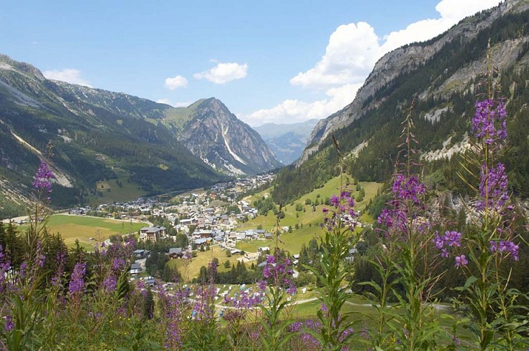
A superb combination near Pralognan, an itinerary steeped in history and (hydro)electricity. This route is located on a north-facing slope. In wet weather or after a heavy storm, it can be slippery.
Water flows beneath your feet through an underground gallery... This gallery, which starts at the dam downstream from the hamlet of Les Prioux, runs along the ubac slope, i.e. the shady north side of the mountain, as opposed to the sunny adret side, before crossing under Mont Bochor and Mont Chevrier. The water ends its wild journey at Villard du Planay, where it powers the turbines of a hydroelectric power station. Along the way, discover the various windows of the underground gallery and the remains of the barracks used by the men who completed the tunnels just after the Second World War. Enter the history of hydroelectricity !
Technical Information
Altimetric profile
Starting point
Points of interest


Date and time
- From 01/06/2026 to 31/10/2026
Additional information
Updated by
Office de Tourisme de Pralognan-la-Vanoise - 18/08/2025
www.pralognan.com/
Report a problem
Environments
Mountain view
Mountain location
Location complements
Nearby car park: Barioz car park
Open period
From 01/06 to 31/10.
Based on the water level, the last section may prove a bit challenging.
Subject to favorable snow and weather conditions.
Topo guides and map references
Map references :
Pralognan-la-Vanoise trail map.
Contact
Phone : 04 79 08 79 08
Email : info@pralognan.com
Guidebook with maps/step-by-step
1. From Place du Barioz (barrier in local dialect) follow rue de l'Erlet to the hamlet of Les Bieux (bouleau in local dialect).
2. Follow the path towards Les Fontanettes (path no. 17). This trail starts at the bachal and leads to an orientation table.
3. A little further up, branch off along the path (trail no. 19c) towards the upper bridge of the Fraîche waterfall.
4. Cross the bridge and climb the path (trail no. 19) to reach a good level at Fenêtre no. 4 (the gallery's only wind tunnel).
5. From the flat, take a slightly airy ledge to the foot of the Grand Marchet wall
du Grand Marchet (path no. 26).
6. At the top of the slalom stadium, continue on the Nanette trail (trail no. 29).
7. You're in the heart of the forest, one of the most beautiful spruce forests in Europe.
(spruce forest) in Savoie, devastated by a storm in 1970. Take advantage of
to appreciate the variety of flora in the area (Aconit Napel, Clématite des
Ancolie, Sabot de Vénus...).
8. At the junction with the Pas de l'Âne path, continue on the Rocher Blanc path (path no. 35). This path crosses a wide avalanche corridor.
9. At the intersection, turn right on the forest track towards the
Camping Municipal (trails no. 36 and 34).
DOWNHILL VARIANT
There are two different ways down: via the slalom stadium (trail no. 27) or via the "pas de l'Âne" trail (trail no. 30).
Animals
Yes
