Alert
Alerts
The Impradine Valley

IGN cards


Description
A path at the bottom of a green valley, overlooked by the majestic Puy Mary, Grand Site de France since 2013. You'll pass through mountain hamlets rich in traditional architectural heritage.
Technical Information
Altimetric profile
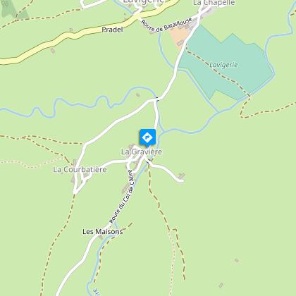
Starting point
Steps
Points of interest

Additional information
Tips
-For your safety, please check the weather forecast before setting off on your hike. -To preserve the environment in which you are located, please avoid leaving garbage in nature. -Remember to take the appropriate equipment for the weather conditions and the hiking itinerary (hiking boots, water bottle, cap, sunglasses, jacket...).
Updated by
Hautes Terres Tourisme - 24/11/2025
www.hautesterrestourisme.fr
Report a problem
Type of land
Ground
Hard coating (tar, cement, flooring)
Open period
All year round daily.
Subject to favorable weather.
Contact
Phone : 04 71 20 22 62
Website : https://www.hautesterrestourisme.fr
Environments
Mountain view
Close to GR footpath
Guidebook with maps/step-by-step
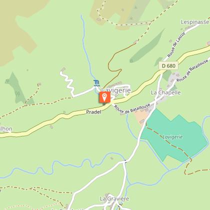
Departure- At La Gravière below the village of Lavigerie. Park on the couderc and head back towards the hamlet of La Chapelle. Turn right and drive over the bridge.
1- Turn left, skirt a large farmhouse on your left, and go up towards the D680, which you must cross.
2- Take the lane on your right which rises in the hamlet. Turn left at the crossroads and continue straight ahead. You will pass the last houses. Leave the track on your right and continue uphill.
3- Leave the tarmac and take the dirt track opposite to reach the village of Gandilhon. At the crossroads, turn right, then right again 20 m further on, to reach the village exit in the direction of Puy Mary.
4- Cross the bridge, continue for 50m and leave the D680 to take the track on the left that descends to the valley floor. Go straight through a gate at Le Mignalou. At the next crossroads, turn left.
5- Take the two footbridges on your right to cross the Impradine stream. Turn left and climb gradually between boulders. Go through a gate. At the next crossroads, follow the tree-lined path to the left towards the Prat Taissy farm. At the crow's-foot, leave the path on the left and continue straight on to the hamlet of Courbatière.
6- In the hamlet, turn left and follow the tarmac road. At the bridge, turn right to return to the starting point.
Animals
No
Data author
