Lake Arvouin loop
Description
A beautiful hike which starts from the centre of the village of La Chapelle d'Abondance and offers superb views of the Cornettes de Bise, the lake of Arvouin, the village and the valley of Abondance.
This hike starts in the centre of the typical Haut Savoyard village of La Chapelle d'Abondance. It is located within the natural site of the Cornettes de Bise, classified Natura 2000.
You will take the road and then follow a forest path in the direction of Chevenne.
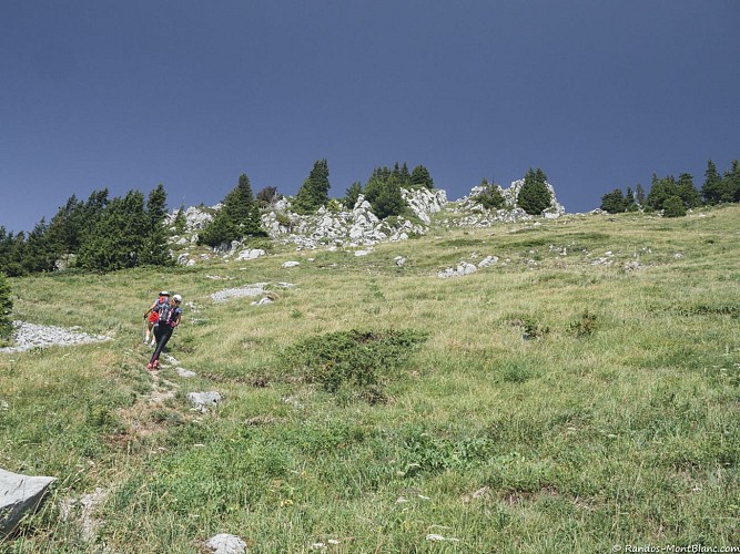
You will then take a pastoral track and a path towards the Vernaz pass at the foot of the imposing Cornettes de Bise mountain. At the pass, a magnificent view awaits you on its southern face.
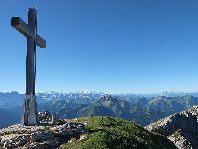
You will then reach the Col de Resse and then the Col du Serpentin and the Tête de l'Avalanche, the highest point of the route at 1854m. This viewpoint on the lake of Arvouin, the Dents du Midi and the valley of Abondance is worth the diversions.
It is also an area frequented by mouflons, marmots and grouse roosters.
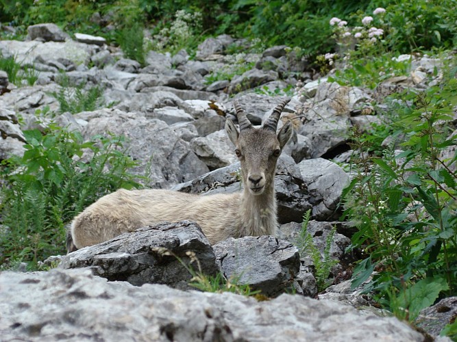
After a short descent through the alpine chalets, you can enjoy a moment of relaxation at the edge of the Arvouin lake. You may meet Abondance cows or ibexes, which are very present on this site.
The return to the village of La Chapelle d'Abondance is via a fairly steep path through the Tête de la Maisonnette mountain pasture and a long descent through the forest.
Technical informations
11 km
|
min. 99999 m
930 m
930 m
| |||
Public : Reserved for experts/confirmed | ||||
Altimetric profile
Starting point
Steps
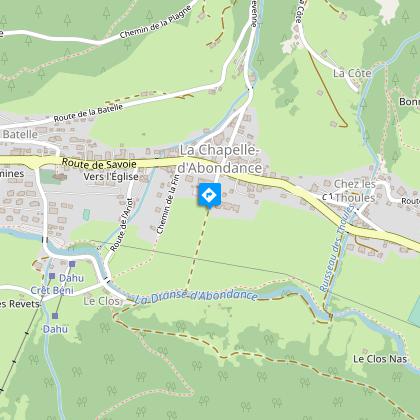
Parking du centre village
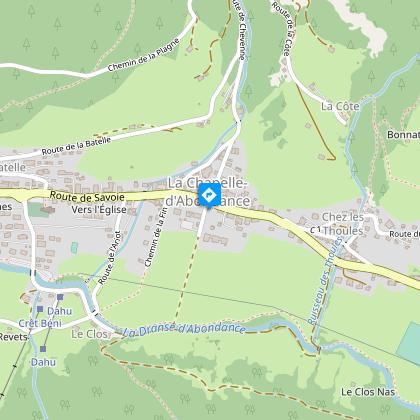
Centre village
Prenez la route qui monte entre la mairie et la chapelle.
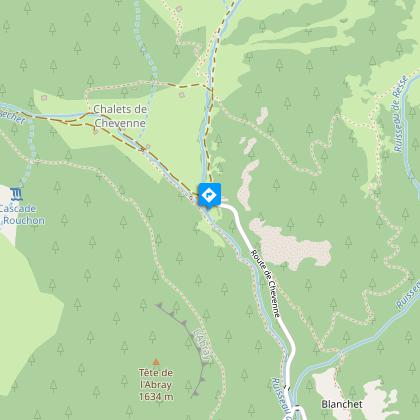
Parking de Chevenne
Au parking de Chevenne, engagez-vous sur le sentier à droite en direction du col de Vernaz.
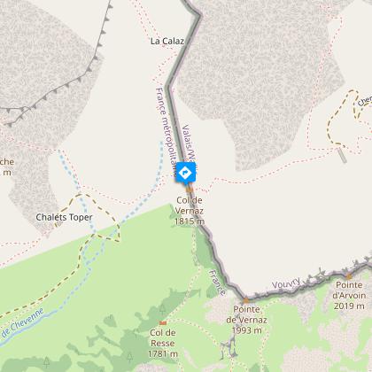
Col de Vernaz
Au col, tournez à droite en direction du col de Resse, puis continuez en direction du lac d'Arvouin.
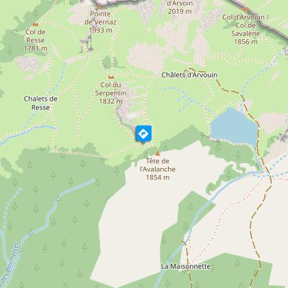
Tête de l'Avalanche
Surplomb au dessus du lac. Descendre jusqu'au lac.
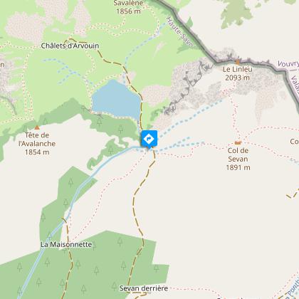
Lac d'Arvouin
Pour le retour, prendre le sentier assez raide qui descend direction la Chapelle d'Abondance.
Points of interest
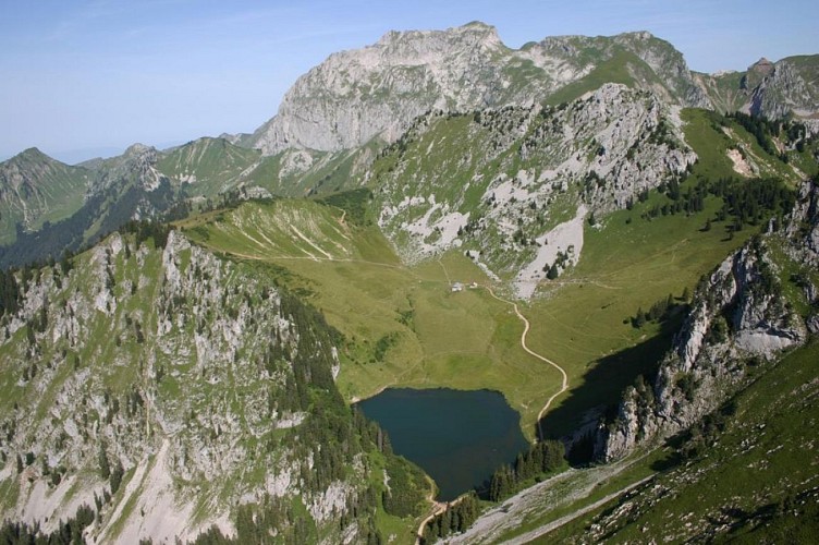
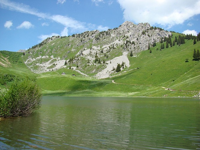
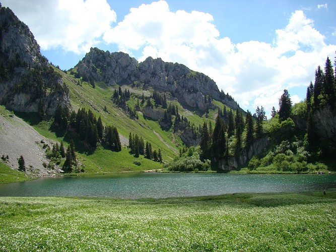
The Arvouin lake
At an altitude of 1663 m, in La Chapelle d'Abondance, this charming little glacial lake is located in the Cornettes de Bise Natura 2000 reserve. Agriculture is very present in its mountain pastures. It is easily accessible on foot and fishing is permitted.Area: 1 hectare 63. Maximum depth: 6 meters. Fishing authorized with an A.A.P.P.M.A. Chablais / Genevois.
The Vernaz pass
Located at the French-Swiss border, at 1815 meters above sea level, the Col de Vernaz (pronounced "Verne") connects the Valley of Chevenne (perpendicular to the Abondance Valley) and the Au de Taney, above the lake of the same name.lt is one of the possible crossing points for the ascent of the Cornettes de Bise.
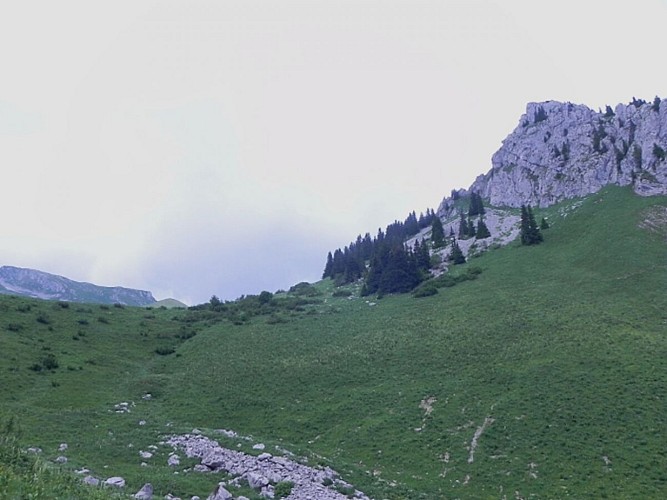
The Resse pass
This pass located entirely in France near the Vernaz pass allows connections between several valleys.In the North-East, a path climbs slightly then crosses level to the north until the Vernaz pass. In the south, a path comes from the chalets of Resse, which can be reached by two routes coming from the bottom of the valley and joining the clearing of Plan de Resse. On the east side, a more or less level path comes from the nearby Serpentin pass, located at the top of the Arvouin valley, above the lake and homonymous chalets.
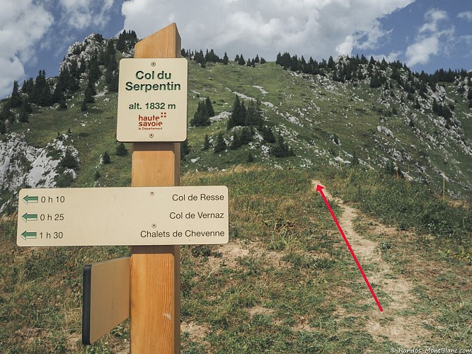
The Serpentin pass
This pass located entirely in France, nestled at 1832m above sea level, near the Vernaz pass and overlooking the alps and the Arvouin lake.
La Pointe d'Arvouin summit
Pointe d'Arvouin is a summit overlooking the lake of the same name. The Pointe d'Arvouin is reflected in the calm water of the lake, and from its summit, we manage to admire an exceptional panoramic view.
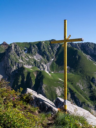
Cornettes de Bise summit
The Cornettes de Bise massif is located between the Abondance valley and the Tanay valley, in Switzerland. Located in the town of La Chapelle d'Abondance, it peaks at 2432 m above sea level and is part of the Natura 2000 network.Chamois, mouflons, golden eagles and notably the Alpine ibex, whose (border) population is estimated at around 700 individuals, can be seen on this massif. Certain species, such as the blue thistle, are also abundant on the site, but are nevertheless rare in France or in Europe. The angular relief of the Cornettes de Bise is composed of hard limestone rocks. The slopes are steep, even abrupt, with numerous rocky bars and scree. By decree of 2 August 2013, the Cornettes de Bise is a classified site because of its picturesque character. A classified site is a remarkable natural area whose historical, artistic, scientific, legendary or picturesque character requires, in the name of the general interest, that it be preserved in its current state and that it be protected from any serious damage (destruction, alteration, trivialisation, etc.). Natura 2000 is a network of protected natural sites throughout Europe, identified for the rarity or fragility of their wild species and the natural habitats that shelter them. The aim is to preserve the biodiversity of these areas in the long term without banning all human activities and to enhance the natural heritage of the area. Natura 2000 is not a nature reserve in the strict sense.
Date and time
- From 01/06/2024 to 30/09/2024
- From 01/06/2025 to 30/09/2025
Additional information
Reception conditions for animals
Dogs must be kept on a leash because of the presence of herds, Natura 2000 reserve.
Updated by
Office de Tourisme Leman Mountains Explore - 09/03/2024
leman-mountains-explore.com
Report a problem
Guidebook with maps/step-by-step
0/ Start : "route de Chevenne".
1/ Take the road to "Chevenne" on foot.
2/ Follow the forest path on your left towards " Chevenne ".
3/ At the Chevenne car park, take the path on your right towards the "Col de Vernaz".
4/ Once at the pass, turn right towards the "Col de Resse" and the "Tête de l'Avalanche".
5/ After reaching the "Tête de l'Avalanche", go down the path towards the "lac d'Arvouin". Rejoin the road that runs alongside the lake.
6/ The return to the village of La Chapelle d'Abondance is done by the path starting at the level of the outlet of the lake and going down through the "Alpage de la Maisonnette".
7/ The itinerary is not recommended without suitable equipment if there is still snow, as the passages in the corridors and on certain slopes are very exposed.
Environments
Lakeside or by stretch of water
Forest location
Lake view
Mountain location
Waterside
Open period
From 01/06 to 30/09.
Accessible except during snow and depending on weather conditions.
Please check with the Tourist Office for the latest information on access conditions. This route is usually suitable for strong walkers during spring, summer, and autumn, except in adverse weather.
Contact
Phone : 04 50 73 51 41
Email : lachapelledabondance@ot-peva.com
Website : lachapelledabondance-tourisme.com
Tricky passages
To cross a steep passage towards the Col de Resse, you will need to use a handrail (chain) for a short distance.
Topo guides and map references
Topo guides references :
On sale in the tourist offices of the Abondance valley.
Map references :
Portes du Soleil hiking map in France and Switzerland
TOP 25 N°3528 ET Morzine Massif du Chablais Les Portes du Soleil
Type of land
Stone
Ground
Grit
Location complements
Free parking under the tourist office or access to the starting point by shuttle (municipal in winter or line C and line 12).
