Hike to Anterne Refuge and Lake


Description
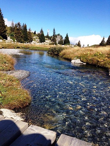
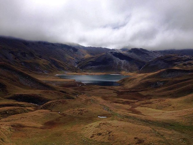
At the foot of the Fiz mountain range, discover a mountain pasture along the waterside. Around the Lake of Anterne, sheep and marmots enjoy their time in the pasture.
Technical informations
20 km
|
min. 99999 m
1080 m
1080 m
| |||
Altimetric profile
Starting point
Points of interest
Le Chalet du Lignon
3 km after the Cascade du Rouget, come and eat in an authentic setting in the Nature Reserve Sixt.
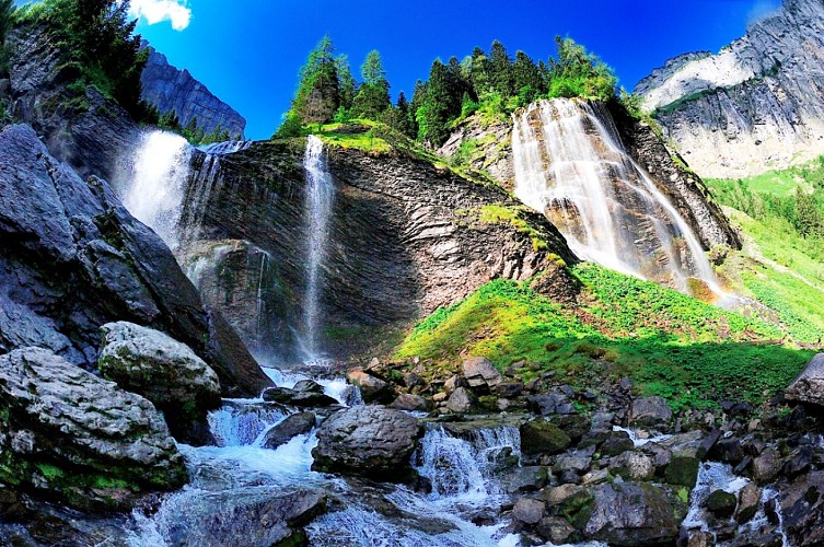
Cascades de la Pleureuse et de la Sauffaz
The Sauffaz's waterfall is fed by the torrent of the small valley of Sales, low forming the Cascade du Rouget. The Pleureuse's waterfall owes its name with the fact that the water which feeds it, comes from the resurgences pointing out the flow of tears.Sauffraz waterfall gets its source from the torrent in the small valley of Sales, leading to Rouget waterfall lower down. The Pleureuse waterfall owes its name to its water source coming from seeping water that resembles tears (pleurer = 'to cry' in French).
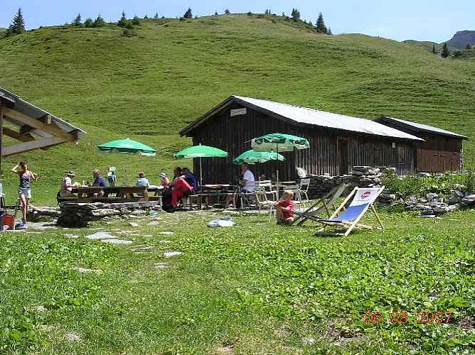
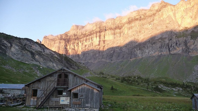
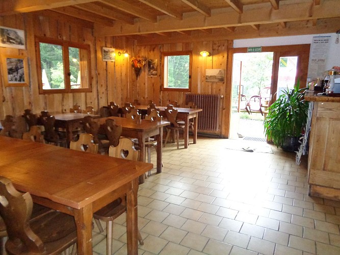
Alfred Wills mountain refuge
Authentic, simple and good quality, this mountain refuge hut is located at the "Chalets d'Anterne". Accessible from Sixt in two hours via the beautiful waterfall of La Pleureuse. it is advisable to arrive in the afternoon to allow time to enjoy the peace and quiet of the surrounding pastures. For children from 5.This eco-friendly alpine chalet offers a simple welcome for 2 to 10 people. Duvets and pillows are provided. Facilities include a shower, three toilets and wash-basins. Bring your own sheet sleeping bag, or hire one of ours. The team has created a mountain ambiance with typical dishes and a choice of organic wines. During the day we offer baked ham and cheese, omelettes, selection of cold meats, home-made bilberry tart and drinks. Dinner : (Following resupply) : home-made soup, roti-polenta or fondue, home-made dessert. Departure possible from Plaine Joux as part of the tour des Fiz
Date and time
- From 01/06/2024 to 30/09/2024
- From 01/06/2025 to 30/09/2025
Additional information
Updated by
Haut-Giffre Tourisme - 29/03/2024
www.haut-giffre.fr
Report a problem
Guidebook with maps/step-by-step
The departure point is Lignon car park, above the Rouget waterfall (elevation 1,180 metres). You'll pass the very beautiful waterfalls of Sauffaz and Pleureuse, then continue left towards the Collet d'Anterne. The path takes you gently up to the Anterne refuge (1,810 metres).
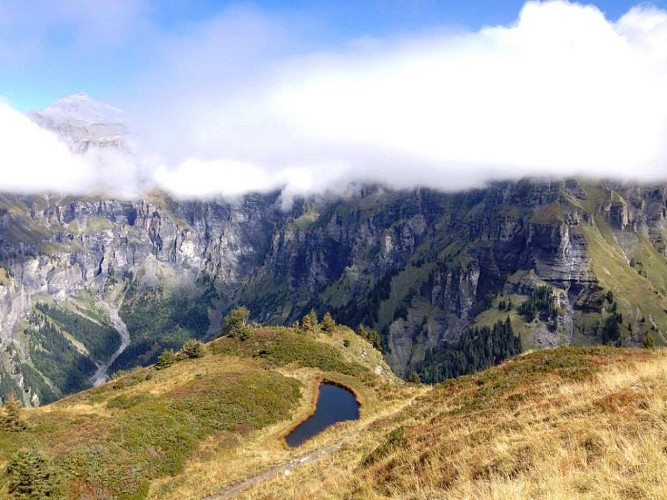
From the refuge, continue south. The path is quite steep to start with. It takes you to Anterne lake where you can admire the Fiz mountains. To return, take the path on your right as far as the "little pass" of Anterne, from where you'll enjoy a stunning view of the Cirque des Fonts. From the "little pass", the path down to the chalets of Les Fonts is fabulous. Then take the vehicle track for 2 km down to Salvagny. Leave the track, turning left onto a signposted path which leads to the Oua bridge, then the Fardelay chalets. Then take the path that cuts across the hairpin bends in the road to join the Rouget waterfalls. Path not practicable for pushchairs.
Contact
Phone : 04 50 34 49 36
Email : contact@haut-giffre-tourisme.fr
Website : www.valleeduhautgiffre.fr
Data author
