Alert
Alerts
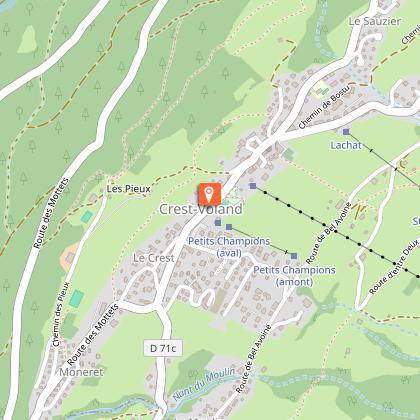
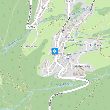
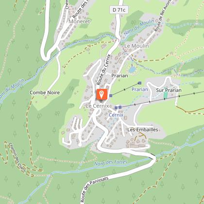
Snowshoe itinerary : From village to village: Crest-Voland / Le Cernix

IGN cards


Description
Small easy walk connecting the village of "Crest-Voland" to the hamlet of "Le Cernix".
TO KNOW :
The hamlet of Cernix belongs to the municipality of Cohennoz, whose capital is 5 km away. In the past, because of this distance, the inhabitants of Cernix went to school and to the Church of Crest-Voland, while those of the chief town went to Héry sur Ugine, on the opposite slope, until the building of their own Church in 1766. Since the 1960s, Le Cernix has been oriented towards tourism and equipped with ski lifts. The hamlet has become urbanized and concentrates 90% of the population in the year of Cohennoz.
Technical Information
Altimetric profile
Starting point
Points of interest


Date and time
- From 15/12/2025 to 15/04/2026
- From 15/12/2026 to 15/04/2027
Additional information
Open period
From 15/12 to 15/04.
Subject to snow conditions.
Updated by
Office de Tourisme du Val d'Arly - 03/11/2025
www.valdarly-montblanc.com
Report a problem
Contact
Phone : 04 79 31 62 57
Location complements
Accessible via the Navette Station (Centre-village stop).
Free parking close to the Tourist Office.
Topo guides and map references
Topo guides references :
Map of snowshoeing and ski touring itineraries in the Val d'Arly on sale for 4€ in the Val d'Arly Tourist Offices (itinerary no. 7)
Map references :
Map of snowshoeing and ski touring itineraries in the Val d'Arly on sale for 4€ in the Val d'Arly Tourist Offices (itinerary no. 7)
Type of land
Non-groomed itinerary
Environments
Mountain view
Mountain location
Ski resort
Village centre
Resort centre
Close to a public transportation
Near shuttle stop
Bottom of slopes
Guidebook with maps/step-by-step
1/ Leave the Tourist Office. Cross the RD71 (take care) and take the path opposite the Bar-Tabac, chemin des Bernades. Go downhill for about 150 m at the end of the dead-end road to reach the start of the route on your left.
2/ The first part of the route runs beneath the village in an alternating clearing and forest.
3/ The route then climbs back up to the RD71A, route des Mottets. Turn left and follow this road for 100 m, then leave it and turn right at the ‘Crest-Voland’ village entrance sign.
4/ Continue towards Le Cernix, following the route through the clearings below the RD71C, route du Cernix. The end of the route is on the Place du Cernix.
5/ Return by the same route.
Animals
Yes. Dogs must be kept on a lead.
