Alert
Alerts
Snowshoe itinerary : Mont-Lachat via Les Reys
IGN cards


Description
Hike to the summit of Mont Lachat to enjoy the panorama.
TO KNOW :
Crest-Voland Cohennoz is an ideal balcony on the Aravis range, this 35 km long Pre-Alps massif, whose high crest line rises more than 2000 m. The most recognizable summit is Mont-Charvin, a sort of limestone pyramid 2049 m high. The Col des Aravis (1486 m) is the only passage through this mountain barrier. On the far right, you can see Pointe Percée, the highest point in the Massif des Aravis (2,752 m), in the distance.
Technical Information
Altimetric profile
Starting point
Steps


Points of interest


Date and time
- From 15/12/2025 to 15/04/2026
- From 15/12/2026 to 15/04/2027
Additional information
Open period
From 15/12 to 15/04 daily.
Subject to snow conditions.
Updated by
Office de Tourisme du Val d'Arly - 26/11/2025
www.valdarly-montblanc.com
Report a problem
Contact
Phone : 04 79 31 62 57
Location complements
Free parking nearby. Accessible by Navette Station (Centre-village stop).
Topo guides and map references
Map references :
Map of snowshoeing and ski touring itineraries in the Val d'Arly on sale for 4€ in the Val d'Arly Tourist Offices (itinerary no. 10)
Type of land
Non-groomed itinerary
Environments
Near shuttle stop
Mountain view
Mountain location
Bottom of slopes
Close to a public transportation
Resort centre
Village centre
Ski resort
Guidebook with maps/step-by-step
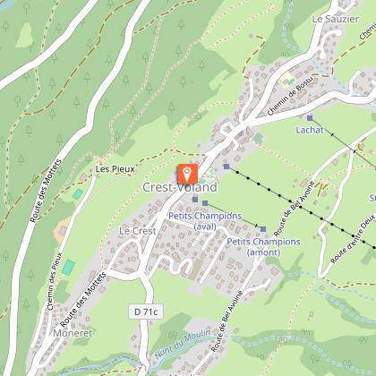
1/ Leave the Tourist Office. Head towards Les Saisies on the RD71A for around 50m. Turn left onto the Chemin de Bostu and go to the end of the dead-end road for 100 m to reach the start of the itinerary.
2/ The first part of the route is flat on an existing track. At the ‘Le Bostu’ crossroads, turn right and head up into a wooded area, then out into a clearing.
3/ Cross the access road leading to the houses and continue parallel to the road.
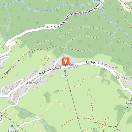
4/ Continue towards the houses. Cross the RD71A (take care), keep to the left of the Reys ski lift and head back up towards the Crestera ski lift.
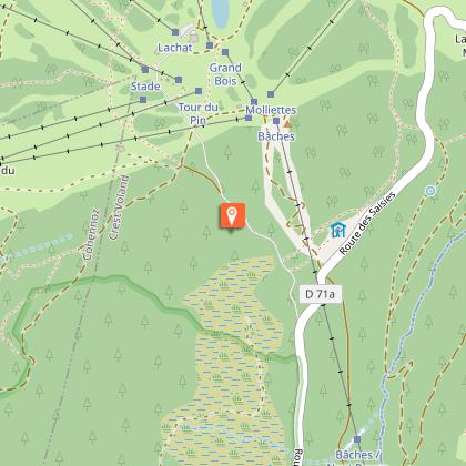
5/ The route then skirts the ‘Desserts’ ski slope (beware of skiers) and continues as far as the Molliettes ski lift. Cross at the foot of the ski lift and walk up the side of the piste towards the Lachat refuge.
6/ The route continues through the forest. Pass behind the refuge and cross a ski slope again. The route then joins a groomed footpath to Mont-Lachat.
7/ Return to the village by the same route or via the Cernix or TS de La Logère.
Animals
Yes. Dogs must be kept on a lead.
