Alert
Alerts
HAUTES VALLÉES LUCHONNAISES


Description
An exceptional trail linking the refuges of the high Luchon valleys.
Designed to be completed in 4 to 6 days, this sporting itinerary offers a unique immersion in the grandiose landscapes of the Haut-Garonne Pyrenees.
Along the way, hikers will discover spectacular panoramas of mythical peaks such as Aneto (3404 m), Pic du Maupas (3109 m) and Pic des Crabioules (3116 m).
The lakes of Oô, Espingo, Bleu, Charles, Célinda, de la Montagnette and the Boums du Port punctuate the route, inviting you to stop off for a peaceful, refreshing break.
Designed as a long-distance trek, this route offers several variants, so that everyone can adapt their itinerary according to their physical condition and their desire for adventure.
4 stages:
- Granges d'Astau / refuge d'Espingo: 3h - D+: 850m
- Refuge d'Espingo / refuge du Maupas: 7h30 - D+: 1104m
- Refuge du Maupas / refuge de Vénasque: 9h - D+: 1335m
- Refuge de Vénasque / Hospice de France: 2h or 4h.
Technical Information
Altimetric profile
Starting point
Points of interest


Additional information
Signage
Yellow
Detailed stages
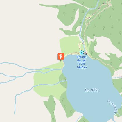
Stage 1 - Granges d'Astau / Refuge d'Espingo - The trail starts from the Astau barns. The track is wide - the slope gentle and regular and mainly wooded.
After a few minutes' walk, look out for the "souffrée" rock on your left. Further on, the track straightens out a little and twists upwards. As you emerge from the forest, you can see a small stone bridge, the Lac d'Oô dam (1439m) and the eponymous refuge on the right.
- Continue straight ahead. The path overlooks Lac d'Oô. On the way up, you cross two small waterfalls, which in hot weather are a welcome cool-down point.
The path continues to climb and you pass a flat rock with a splendid view of the waterfall over Lac d'Oô.
Continue on, leaving the GR10 heading towards Superbagnères on your left.
- A few minutes later you reach the Col d'Espingo (1967m).
The refuge is on your right and the lake just below.
As this is a short stage, you can continue to Lac de Saussat (10 mins).
Stage 2: Refuge d'Espingo / Refuge du Maupas - From the refuge, descend to the fork in the path where you will find the GR10 on the right.
The path climbs steadily up to Hourquette des Hounts Secs (2257 m) and continues towards Coume de Bourg (2272 m). Make the most of the exceptional views.
Descend the pass, leaving the GR10 200m further on as it heads towards Superbagnères, and follow the "GRP HVL - Cabane de Sarnès - refuge du Maupas" route on the right.
- The path climbs towards the small pass in front of you. It then continues along a balcony, leaving the Coume de Nère hut (2157m) on the left - signposted.
You are overlooking the Vallée du Lis (Lit means avalanche in local dialect).
Continue along the stony path up to the ridge in front of you (steep but not difficult).
Admire the Cirque des Crabioules.
- Start descending (steep passage) towards the Sarnès hut (2240m, occupied by the shepherd) - signposted.
Once you reach the small Prat Long EDF canal that collects rainwater and water from the Cirque des Crabioules, walk alongside it.
Cross a 1st rocky spur and continue along the path to the EDF pumping station.
- After the station, turn right and follow the normal route up to the Maupas refuge (2450m) (you'll see the path you'll be taking tomorrow on your left).
Stage 3: Refuge du Maupas / Refuge de Vénasque - This stage includes aerial sections at the lakes, which may stop people prone to vertigo. If this is the case, take the route back down to the Vallée du Lis via Lac Vert. After Lac Vert, on the descent, a path leads off to the right to reach the Col du Pinata.
- From the refuge, head towards Lac Bleu (1h).
Shortly afterwards, you cross a rocky ridge equipped with a handrail. The descent continues without difficulty to Lac Bleu (2265m - 1h).
Take the metal footbridge across the Honorine dam to the other side of the lake. Follow the path as it rises in front of you. You have a bird's eye view of Lac Vert.
- The path leads around the Pic de Grauès, climbing a steep area equipped with handrails. Although not technically difficult in dry weather, this aerial section can be a little impressive.
After crossing the ridge, you can easily reach Lac Charles (2291 m - 30 mins) on a slightly downhill path.
Cross the small dam and continue straight ahead along a pretty path on the mountainside to reach Lake Célinda (2395 m - 30 mins) without difficulty.
- You have a beautiful view of the Lis valley.
Follow the clearly visible path that crosses in front of you to a ridge.
The path follows this ridge to quickly reach the Col de Pinata (2152 m - 45 mins).
Turn right, overlooking a cirque. The path continues almost flat but with a few aerial sections. You soon reach the Col de Sacroux (2034m).
- Descend towards the cirque de la Glère as far as the bottom of the cirque (do not take the junction halfway down the slope that leads to the Port de la Glère).
To the right, the path climbs towards the bottom of the coomb, then veers to the right and rises again.
Follow the path carefully and stay alert.
Just before the Lac du Maille (2193 m), which depending on the season can be reduced to 2 small lakes, turn right onto the path that leads around some steep areas.
- You arrive on a ridge overlooking Lac de la Montagnette (2332 m - 25 mins).
Walk alongside the lake and take the path up to the Col de la Montagnette (2421m - 15 mins).
You will overlook the Boums du Port and the Vénasque refuge (2250 m), which you will reach in around twenty minutes.
Stage 4: Refuge de Vénasque / Hospice de France - Option 1- direct descent - Duration: 2 hours
You can reach the Hospice de France directly via a winding descent.
- Option 2 - the most emblematic, we recommend it - Duration: 4 hours
Follow the winding path from the refuge to the Port de Vénasque (30 mins).
At 2444m, enjoy the unique view of the Maladetta massif and the peak of Aneto (3404m), the highest summit in the Pyrenees.
- Go downhill for a hundred metres on the Spanish side, then turn left onto the path leading to Port de la Picade.
Begin the ascent to Port de la Picade and continue downhill on a stony path towards Pas de l'Escalette.
Continue along the well-marked path back to France and start the descent towards the Crête de Crabidès, straight on to the Pas de Mounjoye (boundary marker no. 336).
- At the small pass, turn left towards the Roumingau pastures and the Campsaure plateau.
At the crossroads, turn left and descend towards the Hospice de France.
End town
BAGNERES-DE-LUCHON
Start town
OÔ
Contact
Tel : 05 61 79 21 21
Website : www.pyrenees31.com
Email : info@pyrenees31.com
Data producer
Contact : HAUTE-GARONNE TOURISME / OFFICE DE TOURISME PYRÉNÉES 31
Phone : 05 61 79 21 21
This information comes from the Haute-Garonne Departmental Tourism Network and is synchronized as part of the partnership between Cirkwi and Haute-Garonne Tourisme.
Data author
