Walk along the second wall
Description
Walk along the second wall of Brussels. From the 'Bruxelles, les chemins de ronde - Circuit de la deuxième enceinte' folder from the Monuments and Sites service of the Brussels Capital Region.
Informations techniques
Profil altimétrique
Point de départ
Étapes
Second wall
Like the first wall, the second wall of the city was built on an earthen embankment in which heavy foundation pillars were buried. In the lower area of the city the moat was filled with water. In the higher parts (Schaerbeek, Louvain and Namur port) the moat was dry. In the 16th and 17th century, under the Spanish regime, the ramparts were strengthened. Impressive earthen structures (towers and ravelins) were built to better defend the city.
Disappearance of the wall
The evolution in warfare made the city fortifications useless at the end of the 18th century. First, some gates were broken down, the walls became walking places with a nice view. In 1810 Napoleon gave the order to completely break down the walls and replace them with wide avenues.
The small ring road
The small ring road follows the old route of the second city wall. In the 19th century these avenues were modern roads with large mansions and luxury traders. People came there to walk and soon the first tramlines were built. Then the trees disappeared from the landscape and the pedestrians had to move for cars. From 1957 tunnels were constructed, initially for cars, and later for the metro.
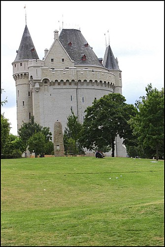
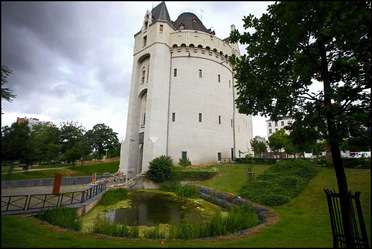
Porte de Hal - Hallepoort
The Porte de Hal is the only significant remnant of the second wall. During the breakdown, it was spared because it served as a prison. Later it became a museum of weapons and it was converted into a neo-gothic monument by architect Henri Beyaert. Following the closure of the museum in 1974, temporary exhibitions were being held at the Porte de Hal. After a renovation the tower opened again permanently in 2008. The Halle Gate is now a museum about the history of Brussels and the second city wall.
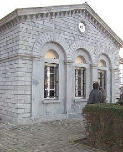
The tollhouses
While the ring boulevards were being built, the city was still surrounded by a fence that separated it from the countryside. This fence did not play a defensive role anymore, but it ensured that access to the city was only possible via gateways. There were 14 gates, pavilions in neoclassical style. At these gates the toll on goods was collected. When the toll was abolished in 1860, the euphoric population destroyed the fence around the city. The tollhouses of the Porte d'Anderlecht and the Porte de Ninove still exist today. The pavilions of the Porte de Namur were moved to the entrance of the Bois de la Cambre, at the end of the Avenue Louise.
