Sensitive natural area of the hill of Montassis
Description
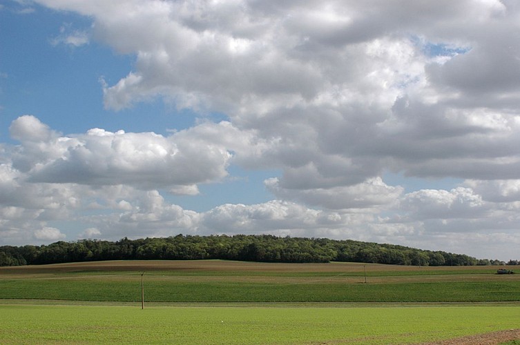
The sensitve natural area of the hill of Montassis, with a surface area of 46 hectares, culminates at 164 m and dominates the country of France to the south and the Multien plateau to the north.
The site is part of a set of witness mounds*, called the Goële hills, which form a striking axis in the landscape of the North of Seine-et-Marne.
Like most nearby hills, the Montassis hill has only been fully wooded for a relatively recent past. At the beginning of the 20th century, its southern and western flanks were planted with vines and orchards.
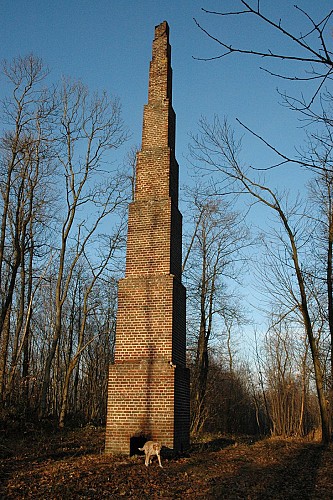
Its strategic location quickly gives it importance to communicate or observe the surroundings. In the first half of the 19th century, the high point of the hill was equipped with a Chappe telegraph, named after its inventor. With a long distance communication mechanism, this is the quickest way to transmit messages.
The wood of the telegraph, as it is still called today, no longer has any traces: the telegraph has been replaced by a geodesic chimney built by the Geographical Service of the army (SGA), ancestor of the Institute national geographic (IGN). At the beginning of the 20th century, it enabled cartographers to carry out precise surveys for the establishment of staff maps.
It was this same strategic position that made the hill the scene of a bloody episode at the start of the First World War. On September 5, 1914, a brigade of Moroccan troops attempted to take the hill held by the German army. The assault, in the open, was terrible and the brigade suffered heavy losses before being supported by French troops from the west. The German troops end up turning back. These battles will forever be associated with the first battle of the Marne, which prevented the capture of Paris.
The wood subsoil, rich in gypsum *, was exploited from 1971 to 1986, mainly towards Penchard.
Apart from some marked depressions, resulting from the obstruction of the galleries by caving *, this underground exploitation has left few visible traces in the perimeter of the ENS.
The Municipality of Chauconin-Neufmontiers has long valued this hill which dominates the village, in particular with the opening of a historic circuit and the restoration of part of the paths which cross the wood.
In order to strengthen the protection of heritage and the natural environment on the site, the Department decided to classify it as a sensitive natural area in 2007.
Technical information
Altimetric profile
Additional information
Tips
Do not miss Captain Hugot-Derville's stele at the edge of the wood and the geodesic chimney at the top of the hill
Contact
Phone : 01 64 33 02 26
Email : tourisme@meaux.fr
Open period
All year round.
Subject to favorable weather.
Reception conditions for animals
Dogs allowed on a leash.
Updated by
Seine et Marne Attractivité - 12/01/2024
www.seineetmarnevivreengrand.fr/
Report a problem
Price(s)
Free access.
Data author
