Discovery trail of Trevezel Gorges
Description
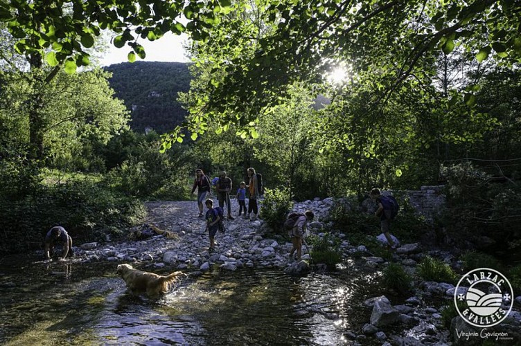
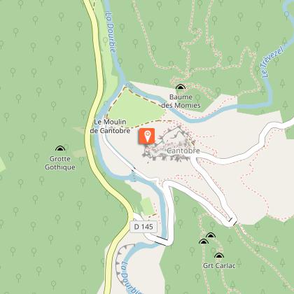
Around Cantobre, a village perched on a promontory of Causse Bégon, a walk in the gorges of Trévezel, whose steep slopes are home to an exceptional biodiversity.From the parking, take the D145 for 380m to reach the village of Cantobre.At the exit of the village, turn left (leave the road) and enter the path that goes into the woods. First narrow and steep, the path becomes more comfortable. Continue for 450 m.At the treatment plant, the path leads to an intersection. Take the path opposite.Continue straight on the path (don’t cross the fording). The path continues with a track to the mill (follow yellows signs).From the mill, take the small road along a stream for 900 m and then goes up towards Cantobre.Turn left and go up the path for 150 m , then turn left again to reach the village of Cantobre.
Technical informations
3 km
|
max. 527 m
min. 448 m
| |||
Altimetric profile
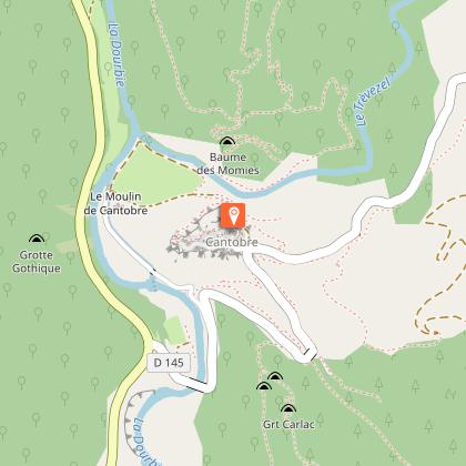
Starting point
Steps
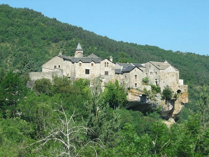
Eglise St-Etienne de Cantobre
L'église Saint-Etienne de Cantobre, rattachée en 1135 à l'abbaye de Nant, est devenue paroissiale à la fin du XIIème siècle. Seules l'abside à trois pans, éclairée par trois fenêtres et la travée du chœur restent romanes. La nef et les chapelles latérales ont été reconstruites au XVIème siècle. Le clocher abrite une cloche en bronze de 1630 elle figure sur la liste d’objets classés M.H. du 5 novembre 1943.
Le gypaète barbu
Depuis 2012, un projet de réintroduction du gypaète barbu a été lancé dans les Grands Causses avec pour objectif de renforcer la population française de gypaètes. Deux sites de lâcher ont été sélectionnés, un à Meyrueis, dans les gorges de la Jonte et un sur la commune de Nant, dans les gorges du Trèvezel.Le gypaète fait partie des 4 espèces de vautours présentes en France et est un des plus grands rapaces d'Europe. Son envergure varie entre 2,60m et 2,90m. En vol, un gypaète adulte se distingue par son plumage contrasté : gris ardoise aux ailes, blanc à orangé sur la tête et le ventre et un collier de plumes noires orne la base de leur cou. Il est nécrophage et se nourrit de restes osseux prélevés sur des cadavres d'ongulés (moutons, chèvres, chamois...). Il peut ingérer des os de 30cm de long. Pour les segments d'os trop volumineux, il casse les os sur des rochers ou des pierriers, ce qui lui vaut le surnom de "casseur d'os".
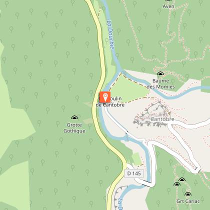
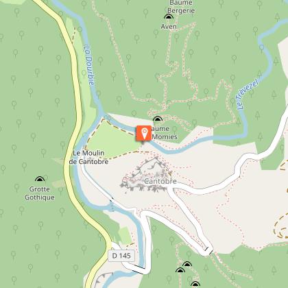
Le moulin et le béal
Situé au pied du hameau, sur la Dourbie, on aperçoit le moulin Cantobre. Autrefois, c'était un moulin bladier, maintenant une micro-centrale électrique. Il est alimenté par un béal (ou canal), qui amène l'eau de la Dourbie retenue en amont par une chaussée. Une passe à poissons a été aménagée contre la chaussée, elle leur permet de remonter la rivière même s'il n'y a plus d'eau qui coule sur la chaussée en été.Source : extrait du livret de Cantobre - Alain et Monique Bonnemayre.
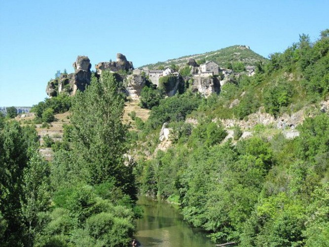
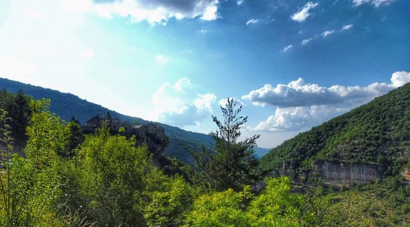
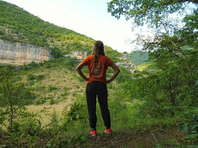
Panorama sur les Gorges de la Dourbie
Depuis le village de Cantobre, observez d'un côté le panorama sur les Gorges de la Dourbie et du Trèvezel et de l'autre celui sur la vallée de la Dourbie.
Points of interest
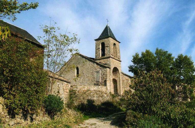
The church Saint-Etienne de Cantobre
The church Saint-Etienne de Cantobre, attached in 1135 to the abbey of Nant, became parish at the end of the 12th century. Only the apse with three sides, lit by three windows, and the span of the choir are Romanesque. The nave and side chapels were rebuilt in the 16th century. The bell tower houses a bronze bell from 1630, it is on the list of objects classified M.H. November 5, 1943.
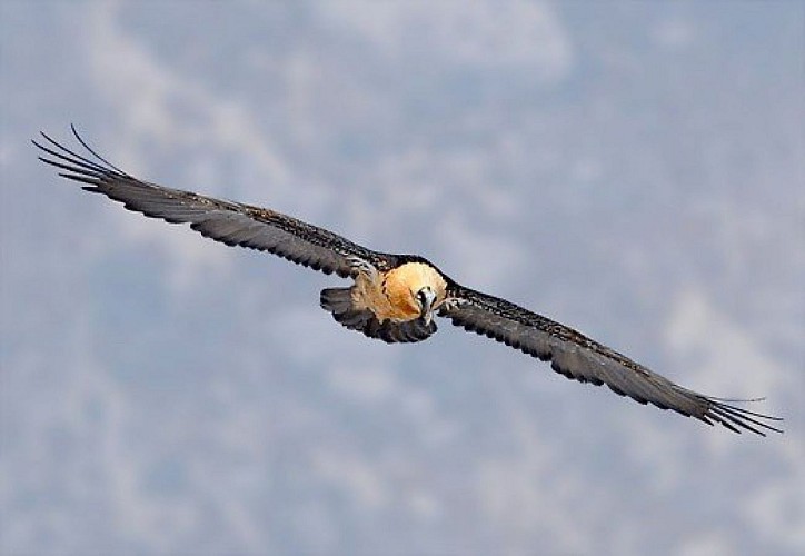
The bearded vulture
Since 2012, a project to reintroduce bearded vultures has been launched in the Grands Causses with the aim of strengthening the French population of bearded vultures. Two sites were selected to let the birds go, one in Meyrueis, in the Jonte gorges and the other in the municipality of Nant, on the Trévezel Gorges.The bearded vulture is one of the 4 species present in France and one of the largest raptors in Europe.It is a scavenger and feeds on bone remains taken from ungulate carcasses (sheep, goats, chamois ...).
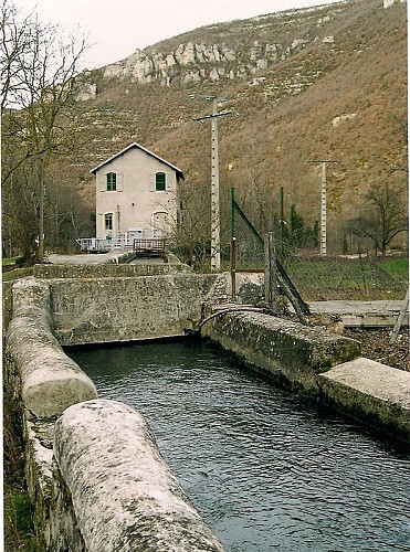
The mill and the canal
Located at the foot of the hamlet, on the Dourbie River, you can see the mill of Cantobre. In the past, it was a mill for grinding wheat, nowadays it is a micro power station. It is fed by a canal, which brings the water of the Dourbie retained upstream by a dam. A fishway has been set against the dam, allowing them to go up the river even if there is no more water flowing on the river in summer.
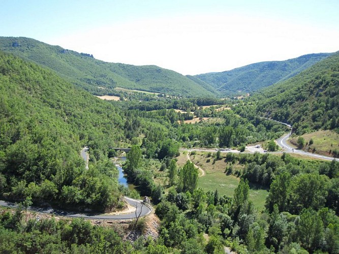
Panorama on the gorges of Dourbie river
From the village of Cantobre, you can admire on one side the panorama on the Gorges of Dourbie and Trevezel and on the other side on the Dourbie Valley.
Additional information
Public transport
To find a means of transport go to Hérault transportThink about carpooling and hitchhiking: Rezopouce
Advice
You cross a sensitive natural area, presenting animal and plant species of heritage interest. Please, stay on marked paths, respect private property and nature. Don’t pick flowers. Bring back your waste, take care of the risk of fires. Keep dogs on a leash. Put on good shoes and take enough water. Check the weather forecast before leaving.
Is in the midst of the park
This itinerary is located in the World Heritage zone Causses and Cévennes, mediterranean agropastoral cultural landscape.
Advised parking
Parking 400m before the entrance of the village
Access
From Millau, take the D991 towards Gorges de la Dourbie, Nant. Then turn left in direction of Cantobre, about 5 km before Nant.
Arrival
Cantobre, Nant
Ambiance
A dizzying cut between the Causse Bégon and the Causse Noir, the gorges of Trévezel display impressive dolomitic rocks overhanging the vegetation of thickets, beech trees, oaks, and black pines. The hike, starting from the beautiful village of Cantobre, revolves around the confluence of the Trévezel, which comes from the Aigoual, with the Dourbie River.
Departure
Cantobre, Nant
Data author
