警报
警报
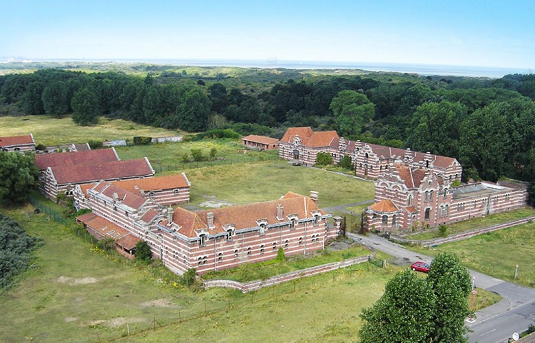
North farm
描述
Built in 1910 for the exclusive needs of the Sanatorium, it includes a set of buildings distributed on the sides of a quadrilateral 100 m wide by 170 deep. It is a rather unique example of an industrial farm, both in size and in its mode of operation. Together with the two other traditional farms, it formed a group whose vocation was to meet all the Sanatorium's food needs. His specialty was the production of food of animal origin, as evidenced by the assignment of shared buildings between stables, barns, pigsty, henhouse, dairy and slaughterhouse. Housing had been planned to accommodate all staff.
During the events of 1940 she was the main infirmary of the Navy following the evacuation of the clinic Villette of Dunkerque.
The very damaged Farm after the war kept its use until 1971 when the North Farm was put at the disposal of the Urban Community of Dunkirk.
From 1977 to 1985 it was the center of an animation center linked to the creation of the Leisure and Nature Base of the North Coast.
Since then, the North Farm is disused, it is the departmental guards who occupy it
技术信息
高程剖面
数据作者
