警报

警报

周围的看点
查看更多
打开
关闭
显示
显示
显示
显示
显示
显示
显示
显示
显示
显示
显示

Oups... 看来 Cirkwi 没有权限使用您的位置。

Presentation
地图
兴趣点
评级和评论
周围的看点

Voie Verte La Traverse

Voie Verte La Traverse

技术信息

公路自行车
难度
非常容易
持续时间
3h
距离
44 km
显示更多信息

高程剖面

起点

De Saint-Just à Saint-Trivier-de-Courtes , 01340   Montrevel-en-Bresse
Lat : 46.335627Lng : 5.126747

兴趣点

image du object

Espace Bresse mountain bike base

Take a trip to the heart of the Bresse countryside for a voyage of discovery into a land of heritage. Happiness is on the way... hands on the handlebars (VTT-VTC-VTTAE-Gravel) 28 marked trails from 6.2 to 53 km - 900 km of marked trailsLocated in the heart of the Bresse region, La Plaine tonique is an area entirely dedicated to leisure activities. It brings together on the same site, a four-star campsite, an aquatic area, a restaurant and a lake dedicated to aquatic and nautical leisure activities, as well as a "Pavillon bleu" beach. 140 hectares of greenery, between lakes and river, provide the backdrop for a day visit, short or long stay. Five interconnected lakes, with beaches, picnic and barbecue tables, playgrounds, a Maison des Sports... a concentration of leisure activities and services. The large lake is the ideal starting point for exploring the byways and landscapes of the Bresse bocage. Home to the characteristic Bresse farmhouses with their Saracen chimneys, this is also the land of the famous Bresse poultry, as well as Bresse PDO butter and cream. Along the Reyssouze river, you'll discover a combination of heritage and nature, mills, wet meadows and gravel pits. Bresse is also a land of ponds, including Pontremble, one of the largest and a favorite of migratory birds, and Bizadan, a Sensitive Natural Area, a marsh in the heart of the forest. A mix of paths between hills and valleys to discover a bocage territory dotted with the famous Saracen chimneys typical of Bresse half-timbered farms. Land of PDO Bresse poultry, Bresse butter and cream. 28 signposted circuits and 7 links On site: - Mountain bike and VTCAE rentals at the Maison des Sports at the leisure center.

599 Route d'Etrez Base de loisirs Plaine Tonique 01340 Malafretaz
- Bourg-en-Bresse destinations - Office de tourisme -
Consulter
image du object

Espace Revermont mountain bike base

Espace Revermont mountain-biking base, accredited by the Fédération Française Vélo. Rendezvous in the heart of the Revermont mountains. 26 circuits, 6 marked trails from 4 to 32 km. - 650 km of marked trailsWith its hilly terrain, wild landscapes and invigorating nature, the Revermont is a great destination for mountain bikers and handlebar enthusiasts. Revermont, a land of mountains. Its sunny slopes stand in stark contrast to the misty mornings of the Bresse bocage. It's a privileged vantage point, with views across the Mâconnais to the Lyonnais mountains, the Jura and the Alps. Prepare your outings according to your desires... descents, false flats and climbs follow one another at a good pace. Cross wild, damp valleys where the moss on the trees is omnipresent. everywhere. The scenery is astonishing. Play with the Revermont mountains and ride across the plateaus on pretty single tracks that alternate between forests, meadows, dry grasslands, hillsides and ridges. Ride along the banks of the Suran or through the narrow streets of picturesque villages. At 660 m, Mont Myon is probably the most sought-after symbol. Listed as a remarkable natural site, it remains a target for many hikers. The Ain Gorge, with its cliffs, wildlife, lookouts and wilderness, is another emblematic Revermont site. Further south, the Revermont vineyards (AOP Bugey Cerdon), dominated by the Cuiron rocks and the Croix de la Dent, with their picturesque villages and vast forests. 5 departure points: Base de loisirs de la Grange du Pin à Cuisiat (Val Revermont), Stade à Simandre sur Suran, mairie de Ceyzériat, mairie de Cize and base de loisirs de l'Ile Chambod. 4 levels / 650 km marked / VTT FFCT label

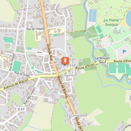
330 chemin de la La Grange du Pin 01370 Val-Revermont
- Bourg-en-Bresse destinations - Office de tourisme -
Consulter
image du object

La cascade de la Vallière, Vallon des Faulx, ENS de l'Ain

This cool, green spot is accessible via a path below the village.The Vallière, which feeds the waterfall, rises in the hamlet of La Grande Fontaine and flows into the Reyssouze after crossing a 30-metre-high rock face. The river receives water from the "Bief de Veau", which originates at the "source des 30 Chiens", under the Côte des Vignes, and from the Tréconnas stream, which originates at the Chantemerle spring. The Vallière has a large, regular flow, and its course used to include three mills spread over almost a kilometer: - The Vallière mill, downstream from the waterfall, existed as early as 1349 and was demolished in 1920. Its stones were used to build the Bouvard cookie factory in the center of Ceyzériat. - Moulin de la Roche, just above the waterfall, which came into operation in 1792. - Moulin des Billets, built in 1836 above the waterfall On the trail of Jehu's Companions... In Les Compagnons de Jéhu, published in 1857, the great writer Alexandre Dumas set an important scene of his novel in a small valley where the Vallière flows, below the church in Ceyzériat. There, in a cave, the writer sets a deadly battle between a regiment of dragoons in Bonaparte's pay and the Compagnons de Jéhu led by their leader Morgan. The Vallière River It rises in the hamlet of Grande Fontaine and flows into the Reyssouze after crossing a 30-metre-high rock barrier: the Vallière waterfall. Pont de la Roche Bridge spanning the top of the Vallière waterfall, and former fortified village gate. This site has been awarded the Espace Naturel Sensible (ENS) label by the Ain department. Real natural and landscaped jewels of the Ain department, sites with the ENS "Espaces Naturels Sensibles" label are managed in such a way as to preserve the biodiversity they host, and are designed to be open to the public (with certain exceptions due to the fragility of the environment).

Rue de la cascade 01250 Ceyzériat
- Bourg-en-Bresse destinations - Office de tourisme -
Consulter

补充信息

Environments

国内
靠近高速公路
镇中心
城市位置
城市郊区
临近公共交通
村中心
5公里之外的湖
5公里之外的河
2公里之外的村庄
在水边
至少300m的海滩
在历史中心
小于500米的骑行道路/环线
不到 500 米处有指示牌的步行路线
不到 1 公里的自行车路线
从法国国家铁路(SNCF)车站步行 20 - 30 分钟即可到达
从法国国家铁路公司(SNCF)车站骑自行车 10 - 20 分钟即可到达

Updated by

Bourg-en-Bresse Destinations - Office de tourisme - 24/11/2025
www.bourgenbressedestinations.fr
Report a problem

Open period

全年 日常.

Type of land

硬路面(沥青、水泥、木板)

动物

评级和评论

周围的看点
查看更多
打开
关闭
显示
显示
显示
显示
显示
显示
显示
显示
显示
显示
显示
注意!
We have no information on the difficulty of this circuit. You may encounter some surprises along the way. Before you go, please feel free to inquire more and take all necessary precautions. Have a good trip! 🌳🥾