Alert
Alerts
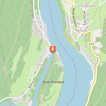
Circuit VTT n°29 (rouge) Côte de Chambod - Val de Buenc
Technical Information
Altimetric profile
Starting point
Points of interest


Additional information
Updated by
Bourg-en-Bresse Destinations - Office de tourisme - 01/06/2026
www.bourgenbressedestinations.fr
Report a problem
Environments
Озеро или водная поверхность менее чем в 300 м
Река менее чем в 300 м
Вид на реку
Вид на горы
В лесу
Менее чем в 10 минутах ходьбы от автобусной остановки
Пляж менее чем в 300 м
У кромки воды
Вид на озеро
За городом
Изолированный
Чувствительная природная территория
Река на расстоянии 5 км
Озеро на расстоянии 5 км
Остановка общественного транспорта менее чем в 500 м
Distinctions
Внесен в список ПДИПР
Метка MTB - FFCT
Open period
В течение всего года ежедневно.
Contact
Phone : 04 74 22 49 40
Email : accueil@bourgenbressedestinations.fr
Website : https://www.bourgenbressedestinations.fr
Type of land
Земля
Жесткое покрытие (гудрон, цемент, помост)
Щебень
Animals
No
