Alert

Alerts

To see around
See more
Open
Close
Show
Show
Show
Show
Show
Show
Show
Show
Show
Show
Show

Oups... It would appear that Cirkwi does not have permission to use your location.

Presentation
Map
Points of interest
Ratings and reviews
See around

Le pont de la Flée

Le pont de la Flée
Le pont de la Flée
Le pont de la Flée
Le pont de la Flée
Le pont de la Flée
Le pont de la Flée
Le pont de la Flée
Le pont de la Flée
Le pont de la Flée
Le pont de la Flée

Technical Information

Walking
Difficulty
Very easy
Duration
2h10mn
Dist.
4 km
Show more

Altimetric profile

Starting point

Départ : parking de Lintre - Phiterne route de Sainte-Anne , 74700   Sallanches
Lat : 45.937445Lng : 6.602301

Points of interest

image du object

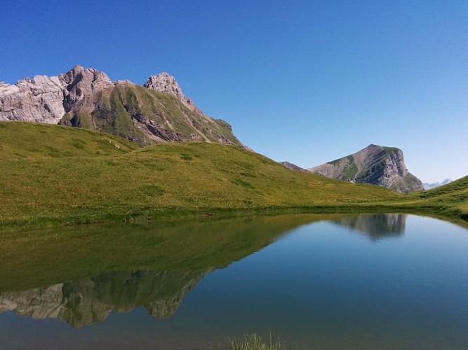
Hiking Trail: La Gouille des Fours Lake (2030 m)

A magnificent hike for experienced walkers in the heart of the Aravis, through mountain streams, waterfalls and alpine meadows, to the famous Gouille des Fours at 2,030 m. The loop return via the Col de Portette and Pierre Fendue offers beautiful panoramic views.Starting from the Lintre, Phiterne car park, this long loop takes you into a wild valley in the Aravis. The route climbs through the alpine meadows of Couterre and Marcolaz before reaching Lanchéron. The climb then becomes steeper and more rugged, with several exposed sections equipped with cables and ladders, before continuing through the alpine meadows towards Les Fours. The route then crosses a vast, lush green valley to the famous Gouille des Fours, at an altitude of 2,030 m. This small mountain pool, well known to the people of Sallanches, is associated with many local legends. Other small pools and wetlands can be found throughout the valley. When mist envelops the valley, the landscape takes on an almost mystical atmosphere, inviting the imagination to run wild. From the Gouille, the route continues to the Col de Portette, at 2,128 m, where, with a little luck, you may spot bearded vultures, chamois or ibex. The descent then leads through a vast scree slope before reaching the Chalets de Cœur and the Frédys alpine pastures. The route continues to the Pierre Fendue, offering beautiful views, particularly of Mont Blanc, before gradually descending alongside the mountain streams to the Pont de la Flée and Pont de Bellecombe, then returning to the starting point. Very difficult route for experienced hikers only. Some sections are steep, rugged, exposed and potentially slippery. The sections equipped with cables and ladders require good mountain experience. Snow patches may also remain at the beginning of the season.

Départ : parking de Lintre - Phiterne Route de Sainte Anne 74700 Sallanches
- Sallanches TOURISME -
Consulter

Date and time

  • From 01/04/2026 to 30/11/2026
  • From 01/04/2027 to 30/11/2027

Additional information

Environments

За городом
Река менее чем в 300 м
В лесу
Вид на горы
У кромки воды
Панорамный вид

Updated by

Office de Tourisme de Sallanches - 15/10/2026
sallanchesmontblanc.com/
Report a problem

Open period

С 01/04 до 30/11.

Type of land

Проложенный маршрут
Земля
Щебень
Приспособленный к коляскам с большими колесами

Animals

Yes

Data author

32 Quai de l'Hôtel de ville 74700 74700 - SALLANCHES France

Ratings and reviews

To see around
See more
Open
Close
Show
Show
Show
Show
Show
Show
Show
Show
Show
Show
Show
Caution!
We have no information on the difficulty of this circuit. You may encounter some surprises along the way. Before you go, please feel free to inquire more and take all necessary precautions. Have a good trip! 🌳🥾