Alert
Alerts
Type of practice
Walking
Medium
4h30mn
Presentation
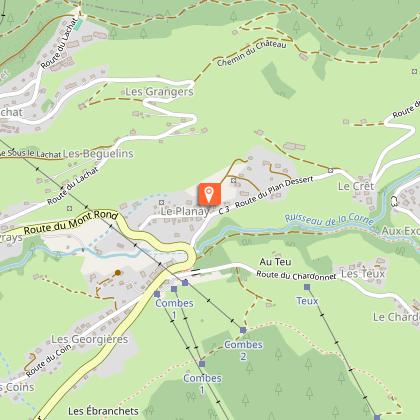
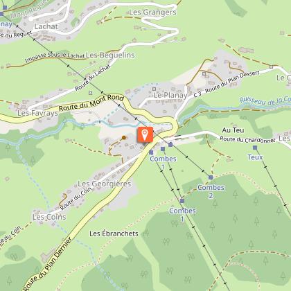
Map
Points of interest
Ratings and reviews
See around
Ban Rouge
Technical Information
Walking
Difficulty
Medium
Duration
4h30mn
Dist.
15 km
Type of practice
Walking
Medium
4h30mn
Show more
Altimetric profile
Starting point
Parking du Mont-Rond
,
73590
Notre-Dame-de-Bellecombe
Lat : 45.804125Lng : 6.550032
Points of interest
Date and time
- From 01/05/2026 to 31/10/2026
- From 01/05/2027 to 31/10/2027
Additional information
Environments
Вид на горы
Панорамный вид
В лесу
В горах
Updated by
Office de Tourisme du Val d'Arly - 23/04/2026
www.valdarly-montblanc.com
Report a problem
Open period
С 01/05 до 31/10.
При наличии снегового покрова.
Contact
Phone : 04 79 31 61 40
Email : sentiers@valdarly-montblanc.com
Type of land
Земля
Неприспособленный к коляскам
Animals
Yes
Data author

Ratings and reviews
To see around