Alert
Alerts
Type of practice
Walking
Medium
2h45mn
Snowshoeing
Medium
2h45mn
Presentation
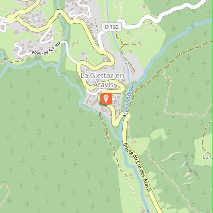
Map
Points of interest
Ratings and reviews
See around
Snowshoeing itinerary : Les Chapets
IGN cards

3531OTR - MEGEVE RESISTANTE COL DES ARAVIS
Editor : IGN
Collection : TOP 25 RÉSISTANTE
Scale : 1:25 000
17.20€

3430ETR - LA CLUSAZ RESISTANTE LE GRAND-BORNAND
Editor : IGN
Collection : TOP 25 RÉSISTANTE
Scale : 1:25 000
17.20€

3430ET - LA CLUSAZ LE GRAND-BORNAND
Editor : IGN
Collection : TOP 25 ET SÉRIE BLEUE
Scale : 1:25 000
13.90€

3531OT - MEGEVE COL DES ARAVIS
Editor : IGN
Collection : TOP 25 ET SÉRIE BLEUE
Scale : 1:25 000
13.90€

TOP75032 - CHAINE DES ARAVIS - MASSIF DES BAUGES
Editor : IGN
Collection : TOP 75
Scale : 1:75 000
9.80€

TOP75004 - BEAUFORTAIN MASSIF DU MONT BLANC
Editor : IGN
Collection : TOP 75
Scale : 1:75 000
9.80€

TOP100D74 - HAUTE-SAVOIE ANNECY THONON-LES-BAINS MASSIF DU MONT BLANC CHAÎNE DES ARAVIS
Editor : IGN
Collection : TOP 100
Scale : 1:100 000
8.40€

TOP100D73 - SAVOIE CHAMBÉRY ALBERTVILLE PARC NATIONAL DE LA VANOISE PNR DU MASSIF DES BAUGES
Editor : IGN
Collection : TOP 100
Scale : 1:100 000
8.40€

202 JURA ALPES DU NORD
Editor : IGN
Collection : TOP 200
Scale : 1:200 000
6.80€

D38 ISÈRE
Editor : IGN
Collection : CARTES DÉPARTEMENTALES IGN
Scale : 1:150 000
5.90€

NR15 AUVERGNE-RHÔNE-ALPES RECTO/VERSO MASSIF ALPIN
Editor : IGN
Collection : CARTES RÉGIONALES IGN
Scale : 1:250 000
6.80€

NR14 AUVERGNE-RHÔNE-ALPES RECTO/VERSO MASSIF CENTRAL
Editor : IGN
Collection : CARTES RÉGIONALES IGN
Scale : 1:250 000
6.80€

SUISSE
Editor : IGN
Collection : DÉCOUVERTE DES PAYS DU MONDE IGN
Scale : 1:303 000
7.00€

EUROPE
Editor : IGN
Collection : DÉCOUVERTE DES PAYS DU MONDE IGN
Scale : 1:2 500 000
7.00€
Technical Information
Walking
Difficulty
Medium
Duration
2h45mn
Dist.
8.3 km
Type of practice
Walking
Medium
2h45mn
Snowshoeing
Medium
2h45mn
Show more
Altimetric profile
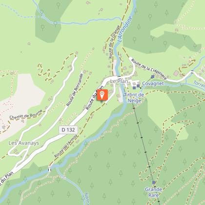
Starting point
Le Plan
,
73590
La Giettaz
Lat : 45.878361Lng : 6.52537
Points of interest


Date and time
- From 15/12/2025 to 15/04/2026
- From 15/12/2026 to 15/04/2027
Additional information
Environments
Vista da montanha
Na montanha
Estação de esqui
No máximo a 300 m das pistas
Updated by
Office de Tourisme du Val d'Arly - 10/10/2025
www.valdarly-montblanc.com
Report a problem
Open period
De 15/12 a 15/04.
Sob reserva de condições da neve.
Contact
Phone : 04 79 32 91 90
Email : sentiers@valdarly-montblanc.com
Type of land
Via danificada
Animals
No
Data author

Ratings and reviews
To see around