Alert
Alerts
Description
Map
Ratings and reviews
See around
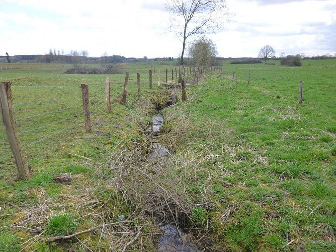
Ruisseau du Pré au Chêne
Description
Le chemin traverse ce ruisseau qui prend sa source à proximité, dans un pré où poussait un chêne, et qui se jette dans la Semois 600 mètres plus au sud, dans la zone de la réserve naturelle des marais de Vance. A proximité de notre parcours, on peut relever "La Truche de la Croix", avec truche ou trûche voulant dire terre inculte, pré sec et devenu sauvage, servant de pâturage. En français, on dirait "friche". Mais aussi "A Fève Moulin", probablement un terrain où l’on cultivait des féverolles (fèves) non loin du moulin banal de Villers-Tortru.
Technical Information
Lat, Lng
49.67895.6761333
Coordinates copied
Altitude
343 m
Uncertain state
Point of Interest updated on 25/07/2019
This point of interest hasn't been updated recently, which could compromise the reliability of this information. We recommend that you inquire and take all necessary precautions. If you're the author, please verify your information.
Altimetric profile
Data author

proposed by
ADEO
Ratings and reviews
To see around