Alert
Alerts
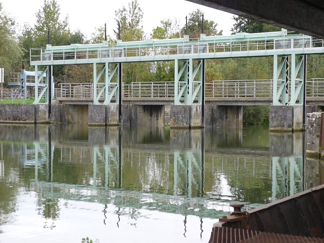
Barrage-écluse de la Sotterie (Coulon)
Description
The current structures were built between 1862 and 1872. The greens, located on the navigable network, are the property of the DDE watching over the river level and the blues belong to the unions of the wet marshes governing the adjacent networks (ditches and conches). Two water body heights are defined for each connecting link (part of a river between two locks and ensuring the maintenance of a water line sufficient for navigation), an upper water level threshold for rainy seasons and a lower threshold for warm seasons. They thus make it possible to reconcile public (boating) and private (agriculture) interests. In 2013, the public river domain was transferred to the Inter-departmental Institution of the Sèvre Niortaise basin. Located on the former haulage road, the Sotterie Lock Dam, classified as a fishing reserve, was restored in 2006.
Technical Information
Altimetric profile
Additional information
Contact
Fixed telephone : +33 5 49 24 18 79
e-mail : info@niortmaraispoitevin.com
Web site (URL) : www.niortmaraispoitevin.com
Typologie de site
Bridge
Infos sur la visite
Conditions de visite : Unaccompanied tours
Data author
