Alert
Alerts
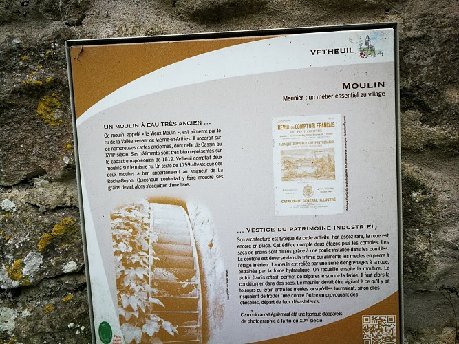
Description
Map
Ratings and reviews
See around
Fin du parcours
Credit
: CDRP92 B L
Description
S’engager à droite sur le chemin des Noues. Longer la D147 sur 70m, la traverser avec prudence et obliquer franchement à gauche pour descendre la ruelle du Moulin. Prendre à droite la rue des Fraîches-Femmes puis à gauche, une sente herbeuse et bifurquer à droite. Poursuivre sur 60 m vers l’esplanade.
Prendre à droite la rue Soignée. La quitter à droite et continuer à gauche dans la rue du château pour atteindre la place de la Mairie. Descendre à gauche en direction de l’Eglise pour rejoindre le parking du point de départ.
Technical Information
Lat, Lng
49.06045761.7011482
Coordinates copied
Altitude
39 m
Uncertain state
Point of Interest updated on 23/04/2019
This point of interest hasn't been updated recently, which could compromise the reliability of this information. We recommend that you inquire and take all necessary precautions. If you're the author, please verify your information.
Altimetric profile
Data author

proposed by
Comité Régional Randonnée Pédestre Ile de France
Ratings and reviews
To see around