Alert
Alerts
The “Roman” bridge
Description
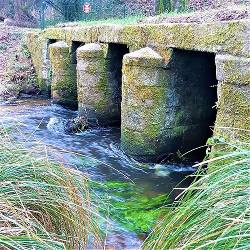
The “Roman” bridge, called Pont an daul in 1843 on the Napoleonic land registry, probably owes its name to the age of the road that crosses it. Although it is difficult to date, architectural surveys have proven that it is not at all Roman but probably predates the 19th century. Its three rounded piers, narrow arches and ashlar stone deck were carefully crafted.
This is unusual for this modest river crossing, which joins the Malachappe and Crano streams just upstream. Symbolic even in its construction, the Pont an Daul gave its name to the entrance to Plouay. The road that ran across it was the main access route to the village. In 1843, on the Napoleonic land registry,despite the existence at that time of the current road, then known as the “nouvelle route”, it was still called Route Royale n° 169 from Lorient to Roscoff. Coming from Kerchopine, it ran alongside the rue de Lann Justice to the church.
