Alert
Alerts
Description
Map
Ratings and reviews
See around
Blavet estuary
Credit
: Lorient Agglomération
Description
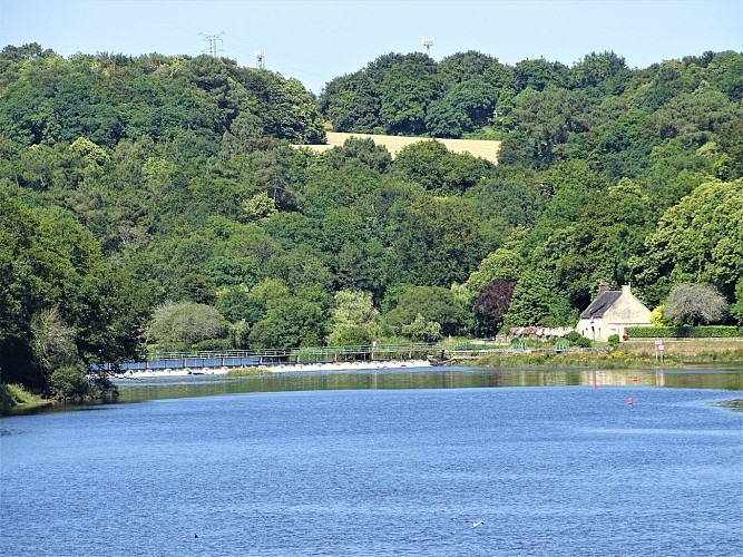
This vast meadow offers a beautiful view over the Blavet estuary. The 163-kilometer river rises at Bourbriac in the Côtes d'Armor department. Connected to the Nantes-Brest Canal, it was channelled between 1806 and 1825. As far as the gates of Hennebont, bridges, ports and locks were built, and a tow path used to facilitate barge traffic.
Polvern is visible upstream with its dam and lockhouse. It is the 28th lock in this system. This is also where the tides stop, as they travel up the estuary for some fifteen kilometres. Sometimes, during very high tides, the rising tide passes over the dam. The landscape shows this meeting of fresh and salt water, in the mudflats and seaweed seen at low tide.
Technical Information
Lat, Lng
47.8172468-3.2865858
Coordinates copied
Altitude
14 m
Point of Interest updated on 21/05/2026
Altimetric profile
Data author

Ratings and reviews
To see around