Alert
Alerts
Description
Map
Ratings and reviews
See around
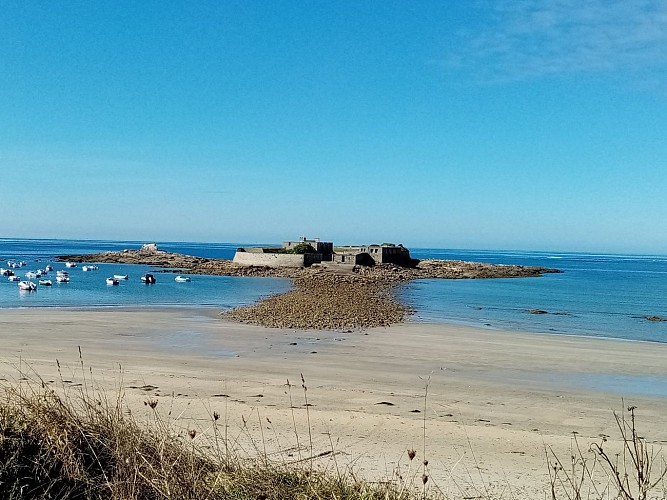
Fort Bloqué
Credit
: Lorient Agglomération
Description
A bit of history: On October 1, 1746, forty English ships landed 4,500 men on Loc'h beach. They took possession of the towns of Guidel and Ploemeur before attacking Lorient, a flourishing city and headquarters of the French East India Company. They were repelled a few days later. To counter another landing, a battery was built in 1748 on the islet of Keragan. Fort Keragan, nicknamed "Fort Bloqué," whose current form dates from the 19th century, is now privately owned and accessible on foot at low tide, becoming an island again at high tide.
Technical Information
Lat, Lng
47.7361847-3.5011625
Coordinates copied
Altitude
6 m
Point of Interest updated on 21/05/2026
Altimetric profile
Data author

Ratings and reviews
To see around