Alert
Alerts
From Kerlédan to Penfrat
Description
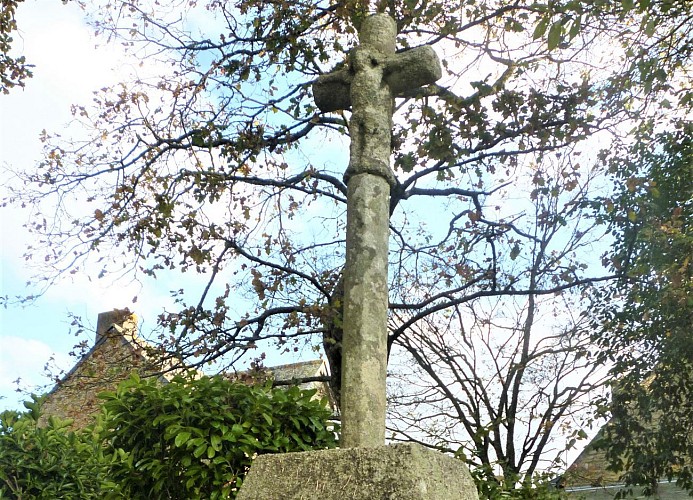
Probably dating from the end of the 17th century, the second cross, also on a monolithic base and an ashlar plinth with a step, is also chamfered and ringed. The crosspiece has a carved Christ on the front and a skull and crossbones on the back.
Passing through the villages of Kerlédan and Penfrat, you will perhaps see what remains of the old stone farms of the 18th and 19th centuries, a house with living rooms upstairs, a barn with its cart door, an oven, a well and a trough.
Under the Ancien Régime, Penfrat was the seat of one of the three seigneuries of Gestel. It belonged to the du Plessis family, also found in Kerouarc'h and Kermartin in Guidel. There are no remaining signs of this past, except perhaps the path to the windmill which you will take shortly. Less common than water mills, windmills located on the heights, were the property of the nobility.
