Alert
Alerts
Brétinio mill
Description
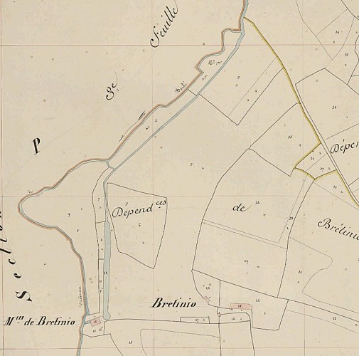
After passing near the village and Brétinio mill, be sure to look to your left, parallel to the path, for the diversion channel that once fed the mill. 500 meters long, it diverted water from the Brûlé stream, better known as the Brandifrout, to turn the mill wheel.
You'll cross this little river several times during your walk. Rising north of Bubry before flowing into the Blavet at the village of Brandifrout, its main tributaries are the Fontaine Saint-Hervé, Locqueltas and Coëtano streams.
Although modest in size, at various times the Brandifrout has supplied water to no fewer than eight mills over its 14 km length: the Rousse mill, the Perros mill, the Brétinio mill, the Coëdiquel mill, the Duc mill, the two Brûlé mills in Bubry, and the Villeneuve Jacquelot mill in Quistinic.The Brûlé mills are among some of the few flour mills still in operation.
