Fort Condé
Description
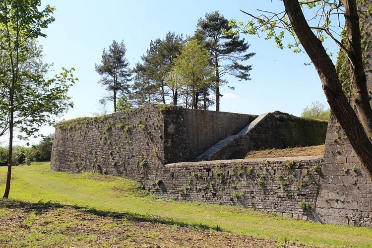
The Fort Condé is built around a rock that was originally topped by a watchtower: the tower Maugis (or tower Villahermosa).
After the annexation of Givet in France in 1678, this tower was destroyed and Vauban built the central redoubt in the rock. From 1725 to 1732, this redoubt was much larger.
The Fort Condé had to defend the east side of Charlemont fortress, as the Fort of Rome had to defend the west side. The ford Condé is located in the plain at about 500 meters from the citadel of Charlemont.
The fort, designed by the engineer Candau, is a pentagon and its perimeter is approximately 400 meters. The front sides form a point facing north and surrounded by moats. These are preceded by a counterscarp within which is a gallery.
Monument not open to the public, in the process of being rehabilitated.
To be noted :
Two long trail designed and accessible for free and open tours : The path of the advanced defences (1.2 km) and the path of the bollards (2.7 km)
Technical information
08600 Givet
Altimetric profile
Data author
