Alert
Alerts
Valleuse d'Antifer

Description
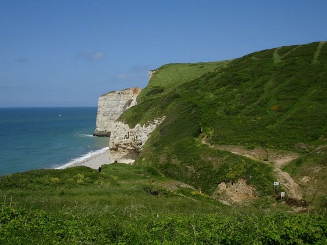
Located in the Pays de Caux region, the Valleuse d'Antifer is a dry valley suspended above the sea. The site offers three remarkably distinct environments: a woodland, a valley made up of meadows, calcareous grasslands, moors and ponds, and the seafront. These different environments are home to numerous animal species (birds, mammals, reptiles, amphibians and insects). Gulls, seagulls and cormorants can often be seen nesting on the cliffs.
A 2km pathway leads down to the sea, where you can discover the site?s diversity of flora and fauna.
The Valleuse d'Antifer was once used by fishermen and pebble miners to access the coastline. Much of the woodland was replanted with chestnut trees and intensively farmed around 1980. The grassy areas were grazed until recently almost exclusively by cattle. Located between Cap d'Antifer and Étretat, it is one of the last undeveloped valleys on the Côte d'Albâtre.
The site is owned by the Conservatoire du Littoral and managed by the Département de la Seine-Maritime.
Technical Information
Altimetric profile
Date and time
- From 01/01/2026 to 31/12/2026
Additional information
Labels
NORMANDIE
Data producer
This information is provided by Office de Tourisme Le Havre Etretat Normandie
Contact
Tel : 02 35 27 05 21
Tel : 02 32 81 68 70
Email : contact@lehavre-etretat-tourisme.com
Email : ens@seinemaritime.fr
Website : https://www.lehavre-etretat-tourisme.com/
Website : https://www.seinemaritime.fr/ens
Rates
Free for everyone
