Alert
Alerts
Nez de Jobourg


Description
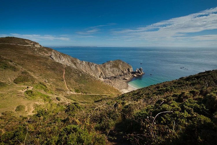
Discover this rock, this peak, this cape? plunging from the top of its imposing cliffs framed by azure coves, it's also a reserve for seabirds.
A breathtaking view of the Channel Islands, a thrill guaranteed!
Le Nez de Jobourg is the name given to the cliffs, which rise to 128 meters and are among the highest in continental Europe.
The panorama here is indeed breathtaking!
As if this rugged beauty weren't enough, the immense promontory, which looks like a sleeping prehistoric monster, is home to an exceptional bird sanctuary on its back. And that's not all. Facing this grandiose landscape is the immensity of the sea, where the Channel Island of Alderney nestles, visible from the coast!
How was such beauty made possible? Perhaps the answer lies in the bowels of the dragon, said to be hiding in one of the four caves beneath the cliffs.
In fact, at the foot of the cliffs, there are several caves with evocative names that are the stuff of legend: the Trou aux Fées and the Grotte aux Lions, for example, have been shaped by the sea. Others, such as the Grotte de la Petite Eglise and the Grotte de la Grande Eglise, which according to legend lead to the village via a tunnel, are said to have served as hiding places for smugglers.
Mostly composed of gneiss over 2 billion years old, the cliffs today are sculpted by erosion and the last phases of glaciation, which caused the upper parts of the soil to slide down the sides of the cliffs.
On the Nez de Jobourg, classified as an ornithological reserve, nest crested cormorants, fulmars, herring gulls and great ravens.
The Nez de Jobourg is used as a maritime traffic monitoring station. The CROSSMA, located some 170 meters above sea level, monitors the English Channel and observes cargo ships and tankers off the Cape.
All that's left is for you to dare an adventure?
Technical Information
Altimetric profile
Additional information
Equipment
Regular activities
Welcoming boards
WC
Reading table
Labels
NORMANDIE
Data producer
This information is provided by Attitude Manche
Contact
Tel : 02 33 10 00 40
Email : mairie-jobourg@lahague.com
Data author
