Description
Map
Ratings and reviews
See around
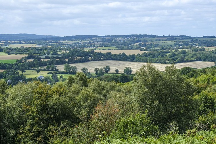
Mont Pinçon Heath
Description
The highest point in Calvados (362m)! Radio and television transmitter with 216 metre pylon covering the entire region of Lower Normandy. Interpretation trail starting from the village of Plessis-Grimoult and leading to the summit. The Mont Pinçon was not only a battlefield, but also a strategic position during the Battle of Normandy. Panorama across the Normandy Bocage from the summit.
Technical information
Updated at : 27/04/2024
Lat : 48.9709142Lng : -0.6114256
Altimetric profile
Additional information
Author
Conseil Départemental du Calvados
Contact
E-mail : milieux_naturels@calvados.fr
Data author

proposed by
Calvados Departement
Caen France
Ratings and reviews
To see around