Alert
Alerts
Description
Map
Ratings and reviews
See around
11-Forêt du Bois le Prêtre
Description
11-Forêt du Bois le Prêtre
Ce massif forestier de 800 hectares au Nord-Ouest de Pont-à- Mousson. Etabli sur une ligne de crêtes, il domine à l’Est le Saillant de Saint-Mihiel.
Son point culminant est situé à la Croix des Carmes, à 372 mètres d’altitude.
Le Bois-le-Prêtre n’a pas été épargné par la Première Guerre Mondiale, c’est un champ de bataille important, où les combats ont été d’une violence extrême.
Présence d'une borne Vauthier
Technical Information
Lat, Lng
48.91635.98916
Coordinates copied
Altitude
373 m
Uncertain state
Point of Interest updated on 09/10/2017
This point of interest hasn't been updated recently, which could compromise the reliability of this information. We recommend that you inquire and take all necessary precautions. If you're the author, please verify your information.
Altimetric profile
IGN cards
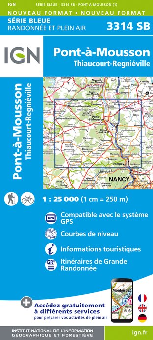
3314SB - PONT-À-MOUSSON THIAUCOURT-REGNIÉVILLE
Editor : IGN
Collection : TOP 25 ET SÉRIE BLEUE
Scale : 1:25 000
13.90€

TOP100D54 - MEURTHE-ET-MOSELLE NANCY TOUL PARC RÉGIONAL DE LORRAINE
Editor : IGN
Collection : TOP 100
Scale : 1:100 000
8.40€

111 METZ VERDUN THIONVILLE PNR DE LORRAINE VALLÉE DE LA MOSELLE
Editor : IGN
Collection : TOP 100
Scale : 1:100 000
8.40€

D54-57 MEURTHE-ET-MOSELLE MOSELLE
Editor : IGN
Collection : CARTES DÉPARTEMENTALES IGN
Scale : 1:150 000
5.90€

ALLEMAGNE
Editor : IGN
Collection : DÉCOUVERTE DES PAYS DU MONDE IGN
Scale : 1:800 000
7.00€

EUROPE
Editor : IGN
Collection : DÉCOUVERTE DES PAYS DU MONDE IGN
Scale : 1:2 500 000
7.00€
Data author

proposed by
Elan cyclotouriste de Champs-sur-Marne et Guerre 14-18
France
Ratings and reviews
To see around