Alert
Alerts
THE FORT OF AS TRAVESAS
Description
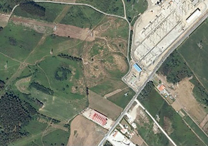
The path continues here on the road, passing in front of an electrical substation. When the fence ends another path can be seen that leads to the fort of As Travesas, also known as Eira dos Mouros. “Mouro” is a popular Galician imaginary being and has nothing to do with the people of North Africa. The “Mouros” live underground and, generally, the legends of “Mouros and charms” are associated with places of archaeological remains.
This fort is on a high plateau and has a circular shape. It is considered to be one of the largest in Galicia. Its position was a privileged one; it was ideal for control of the roads in a large territory. In fact, it is maintained that a roman road passed through here. In the immediate vicinity, and also by the side of the road (at the fork of Ferrol) going up Beche, there is another fort; Castro Maior.
The fort was excavated in 2006 and it is believed that the first occupants date back to the 4th or 3rd century BC. Amongst the discoveries were the remains of wooden houses with organic coverings, a ring with parallels to those of the British Isles, a mud object profusely decorated and materials from the Mediterranean and Roman world. The finds are stored in a visitable collection in Carral.
Technical Information
Altimetric profile
Data author
