Alert
Alerts
Description
Map
Ratings and reviews
See around
Reading the landscape
Credit
: Office de tourisme du Pays des Écrins
Description
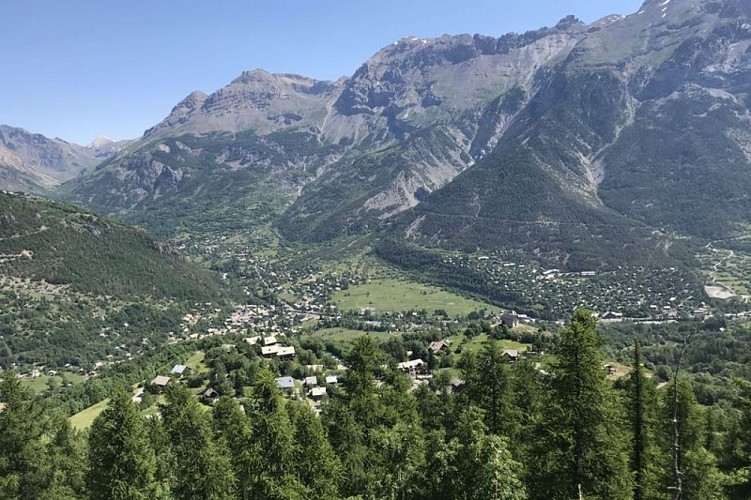
The Vallouise valley is a tributary valley on the right-hand bank of the Durance. It is made up of three municipalities: Vallouise-Pelvoux, Les Vigneaux and, looking down from the heights, Puy-Saint-Vincent. This 25 km-long valley is dominated by numerous peaks, ranging in altitude from 980 metres, at the confluence of the Durance, to the peak of the Barre des Écrins at 4,102 metres (the highest point in the Les Écrins massif) and covers 18,541 hectares. Lying at the centre of the crystalline massif, the Vallouise valley is the gateway to the Parc National des Écrins and boasts exceptional and varied landscapes and a diverse wealth of fauna and flora.
Technical Information
Lat, Lng
44.81797326.4931107
Coordinates copied
Point of Interest updated on 10/04/2025
Altimetric profile
Data author

proposed by
Office de tourisme du Pays des Écrins
Rue des Urties 05340 Vallouise-Pelvoux France
Ratings and reviews
To see around