Alert
Alerts
Description
Map
Ratings and reviews
See around
Les Bons Villers
Description
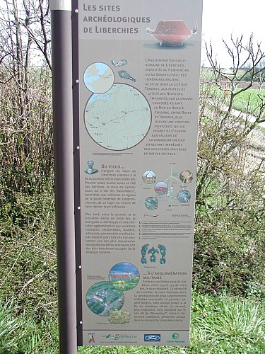
Le site de « Bons Villers » correspond à l’agglomération romaine connue sous le nom de Geminiacum. Ce vicus déployait un habitat assez dense de part et d’autre de la chaussée avec un fanum (temple), des zones d’artisanat (métallurgie, poterie, tannerie) et des thermes à proximité du ruisseau qui traverse le site. L’agglomération connaît une destruction brutale à la fin du IIIème siècle et est abandonnée au profit du site voisin du castellum.
Le matériel archéologique de ce site est visible au musée de Liberchies, de Mariemont et de Nivelles.
Technical Information
Lat, Lng
50.50634.43977
Coordinates copied
Uncertain state
Point of Interest updated on 01/01/1970
This point of interest hasn't been updated recently, which could compromise the reliability of this information. We recommend that you inquire and take all necessary precautions. If you're the author, please verify your information.
Altimetric profile
Data author

proposed by
Archéopass
Ratings and reviews
To see around