Alert
Alerts
Description
Map
Ratings and reviews
See around
D'Arriutort aux pentes du Lorry
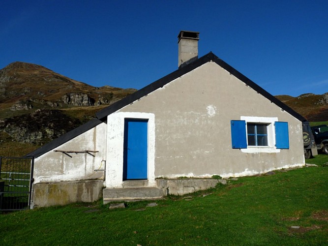
Credit
: CCVO
Description
Partir à droite de la cabane d’Arriutort, passer un colut, descendre puis tirer à gauche près du ruisseau. Remonter sur une croupe à gauche.
0h40 Tourner à droite au niveau d’un replat avec des cailloux. Marcher à flanc en montant légèrement.
1h00 Marcher toujours à flanc.
1h15 Au col d’Arriutort, continuer à flanc en remontant sous un petit sommet rocheux. Passer un petit col et continuer sur l’autre versant. Après un petit lac, remonter à flanc. Suivre le chemin le plus marqué.
1h50 Passer un petit col avec plein de dolines et descendre dans un talweg sur la gauche. Traverser à flanc vers la droite.
Technical Information
Lat, Lng
42.975073-0.471905
Coordinates copied
Uncertain state
Point of Interest updated on 01/01/1970
This point of interest hasn't been updated recently, which could compromise the reliability of this information. We recommend that you inquire and take all necessary precautions. If you're the author, please verify your information.
Altimetric profile
Data author

proposed by
OT Vallée d'Ossau Pyrénées
64440 France
Ratings and reviews
To see around