Alert
Alerts
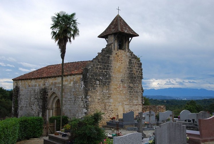
Chapelle de Caubin
Description
A la sortie de Pomps, prendre une route à gauche indiquée « route de Brana ». Continuer tout droit jusqu’à traverser une route plus importante, en prenant garde à la circulation. Quelques dizaines de mètres plus loin, prendre à droite la piste qui traverse un champ de maïs et qui rejoint un bois puis une aire de pique-nique au bord d’une route.
Prendre cette route vers la gauche. D’abord plate, elle monte ensuite vers le hameau de Castillon construit au sommet d’un petit mont. Avant la sortie du village, quitter la route pour prendre en face une piste qui descend bien raide à travers champs pour rejoindre la route plus bas. L’itinéraire passe deux petits ruisseaux puis se poursuit à plat avant d’attaquer une nouvelle montée. Au début de cette montée, tourner à la première intersection à gauche.
Cette route monte sur le coteau en direction d’une route plus importante, mais néanmoins peu fréquentée : la prendre à droite pour arriver très vite à la chapelle de Caubin
