Description
Map
Ratings and reviews
See around
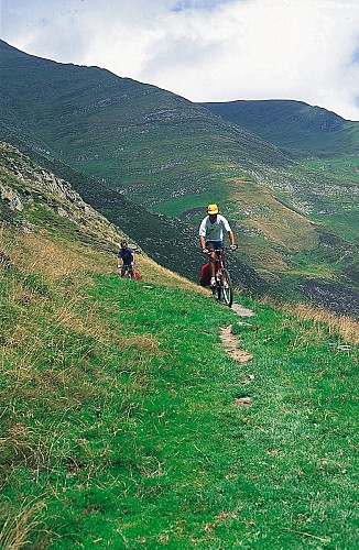
Col de Mehatze
Credit
: © Ph.Laplace
Description
Suivre la route principale. Au premier croisement, prendre à gauche (ne pas descendre). Suivre la route principale et prendre une piste à gauche où il faut pousser.
Suivre ensuite une piste à gauche. Dans la forêt, piste abrupte à droite. Continuer à découvert. Assez rude jusqu’au goudron. Prendre à droite, le goudron va laisser place plus loin à une piste que l’on remonte jusqu’au col.
Technical Information
Lat, Lng
43.107632-1.346609
Coordinates copied
Altitude
-99999 m
Uncertain state
Point of Interest updated on 01/01/1970
This point of interest hasn't been updated recently, which could compromise the reliability of this information. We recommend that you inquire and take all necessary precautions. If you're the author, please verify your information.
Altimetric profile
Data author

proposed by
Office de Tourisme Pays Basque
64502 France
Ratings and reviews
To see around